You are here: Home > Network List > US - United States National Seismic Network Stations List
> Station MIAR Mount Ida, Arkansas, USA > Earthquake Result Viewer
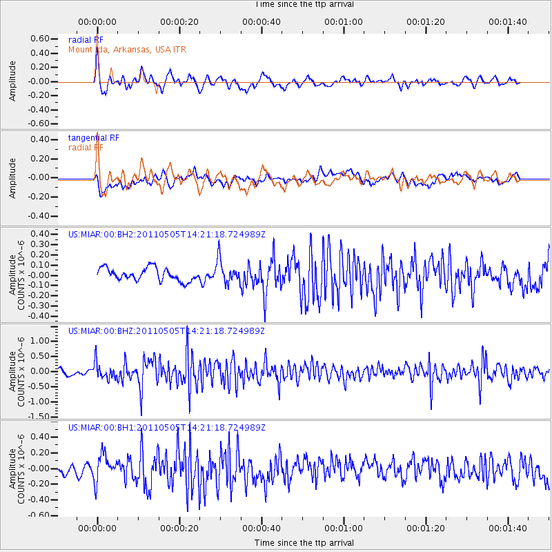
MIAR Mount Ida, Arkansas, USA - Earthquake Result Viewer
*The percent match for this event was below the threshold and hence no stack was calculated.
| Earthquake location: |
Alaska Peninsula |
| Earthquake latitude/longitude: |
55.1/-160.5 |
| Earthquake time(UTC): |
2011/05/05 (125) 14:13:01 GMT |
| Earthquake Depth: |
39 km |
| Earthquake Magnitude: |
5.9 MB, 5.3 MS, 5.7 MW, 5.7 MW |
| Earthquake Catalog/Contributor: |
WHDF/NEIC |
|
| Network: |
US United States National Seismic Network |
| Station: |
MIAR Mount Ida, Arkansas, USA |
| Lat/Lon: |
34.55 N/93.58 W |
| Elevation: |
207 m |
|
| Distance: |
49.6 deg |
| Az: |
85.474 deg |
| Baz: |
316.037 deg |
| Ray Param: |
$rayparam |
*The percent match for this event was below the threshold and hence was not used in the summary stack. |
|
| Radial Match: |
72.83075 % |
| Radial Bump: |
400 |
| Transverse Match: |
61.94336 % |
| Transverse Bump: |
400 |
| SOD ConfigId: |
558545 |
| Insert Time: |
2013-09-18 17:24:10.796 +0000 |
| GWidth: |
2.5 |
| Max Bumps: |
400 |
| Tol: |
0.001 |
|
Signal To Noise
| Channel | StoN | STA | LTA |
| US:MIAR:00:BHZ:20110505T14:21:18.724989Z | 2.6523278 | 2.7228654E-7 | 1.02659456E-7 |
| US:MIAR:00:BH1:20110505T14:21:18.724989Z | 2.6558123 | 1.7090011E-7 | 6.4349464E-8 |
| US:MIAR:00:BH2:20110505T14:21:18.724989Z | 1.8789163 | 1.153916E-7 | 6.1413914E-8 |
| Arrivals |
| Ps | |
| PpPs | |
| PsPs/PpSs | |


