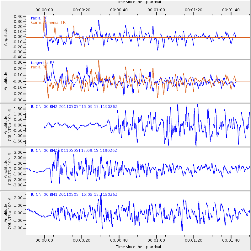
GNI Garni, Armenia - Earthquake Result Viewer
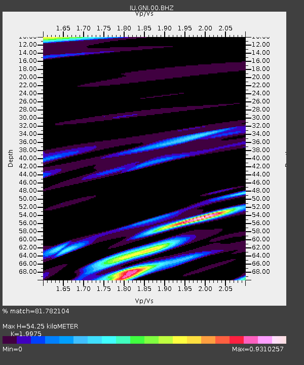
Earthquake location: Off East Coast Of Honshu, Japan
Earthquake latitude/longitude: 38.2/144.0
Earthquake time(UTC): 2011/05/05 (125) 14:58:18 GMT
Earthquake Depth: 11 km
Earthquake Magnitude: 6.2 MB, 5.7 MS, 6.1 MW, 6.1 MW
Earthquake Catalog/Contributor: WHDF/NEIC
Network: IU Global Seismograph Network (GSN - IRIS/USGS)
Station: GNI Garni, Armenia
Lat/Lon: 40.15 N/44.74 E
Elevation: 1609 m
Distance: 72.7 deg
Az: 307.591 deg
Baz: 54.567 deg
Ray Param: 0.05349948
Estimated Moho Depth: 54.25 km
Estimated Crust Vp/Vs: 2.00
Assumed Crust Vp: 6.291 km/s
Estimated Crust Vs: 3.149 km/s
Estimated Crust Poisson's Ratio: 0.33
Radial Match: 81.782104 %
Radial Bump: 400
Transverse Match: 78.45408 %
Transverse Bump: 400
SOD ConfigId: 558545
Insert Time: 2013-09-18 17:25:44.611 +0000
GWidth: 2.5
Max Bumps: 400
Tol: 0.001

Signal To Noise

ChannelStoNSTALTA
IU:GNI:00:BHZ:20110505T15:09:15.119026Z2.4131698.5133803E-73.5278842E-7
IU:GNI:00:BH1:20110505T15:09:15.119026Z1.13072823.905773E-73.4542103E-7
IU:GNI:00:BH2:20110505T15:09:15.119026Z1.40951412.05694E-71.4593256E-7
Arrivals
Ps8.9 SECOND
PpPs25 SECOND
PsPs/PpSs34 SECOND