You are here: Home > Network List > II - Global Seismograph Network (GSN - IRIS/IDA) Stations List
> Station WRAB Tennant Creek, NT, Australia > Earthquake Result Viewer
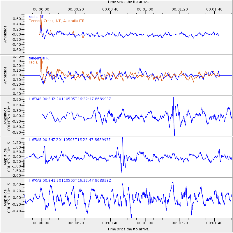
WRAB Tennant Creek, NT, Australia - Earthquake Result Viewer
*The percent match for this event was below the threshold and hence no stack was calculated.
| Earthquake location: |
South Of Fiji Islands |
| Earthquake latitude/longitude: |
-25.2/-177.6 |
| Earthquake time(UTC): |
2011/05/05 (125) 16:15:25 GMT |
| Earthquake Depth: |
185 km |
| Earthquake Magnitude: |
5.6 MW |
| Earthquake Catalog/Contributor: |
NEIC PDE/NEIC PDE-M |
|
| Network: |
II Global Seismograph Network (GSN - IRIS/IDA) |
| Station: |
WRAB Tennant Creek, NT, Australia |
| Lat/Lon: |
19.93 S/134.36 E |
| Elevation: |
366 m |
|
| Distance: |
44.5 deg |
| Az: |
266.648 deg |
| Baz: |
105.987 deg |
| Ray Param: |
$rayparam |
*The percent match for this event was below the threshold and hence was not used in the summary stack. |
|
| Radial Match: |
53.64557 % |
| Radial Bump: |
400 |
| Transverse Match: |
60.09049 % |
| Transverse Bump: |
400 |
| SOD ConfigId: |
558545 |
| Insert Time: |
2013-09-18 17:28:54.798 +0000 |
| GWidth: |
2.5 |
| Max Bumps: |
400 |
| Tol: |
0.001 |
|
Signal To Noise
| Channel | StoN | STA | LTA |
| II:WRAB:00:BHZ:20110505T16:22:47.868993Z | 2.733773 | 4.8337824E-7 | 1.7681727E-7 |
| II:WRAB:00:BH1:20110505T16:22:47.868993Z | 1.4111714 | 2.0249763E-7 | 1.4349611E-7 |
| II:WRAB:00:BH2:20110505T16:22:47.868993Z | 1.5049353 | 2.2255588E-7 | 1.4788402E-7 |
| Arrivals |
| Ps | |
| PpPs | |
| PsPs/PpSs | |


