You are here: Home > Network List > US - United States National Seismic Network Stations List
> Station MNTX Cornudas Mountains, Texas, USA > Earthquake Result Viewer
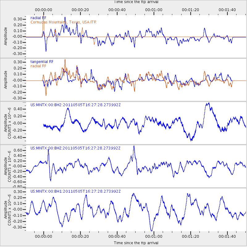
MNTX Cornudas Mountains, Texas, USA - Earthquake Result Viewer
*The percent match for this event was below the threshold and hence no stack was calculated.
| Earthquake location: |
South Of Fiji Islands |
| Earthquake latitude/longitude: |
-25.2/-177.6 |
| Earthquake time(UTC): |
2011/05/05 (125) 16:15:25 GMT |
| Earthquake Depth: |
185 km |
| Earthquake Magnitude: |
5.6 MW |
| Earthquake Catalog/Contributor: |
NEIC PDE/NEIC PDE-M |
|
| Network: |
US United States National Seismic Network |
| Station: |
MNTX Cornudas Mountains, Texas, USA |
| Lat/Lon: |
31.70 N/105.38 W |
| Elevation: |
404 m |
|
| Distance: |
89.1 deg |
| Az: |
54.247 deg |
| Baz: |
239.606 deg |
| Ray Param: |
$rayparam |
*The percent match for this event was below the threshold and hence was not used in the summary stack. |
|
| Radial Match: |
59.082584 % |
| Radial Bump: |
400 |
| Transverse Match: |
55.31345 % |
| Transverse Bump: |
400 |
| SOD ConfigId: |
558545 |
| Insert Time: |
2013-09-18 17:29:49.751 +0000 |
| GWidth: |
2.5 |
| Max Bumps: |
400 |
| Tol: |
0.001 |
|
Signal To Noise
| Channel | StoN | STA | LTA |
| US:MNTX:00:BHZ:20110505T16:27:28.273992Z | 1.8138438 | 2.979336E-7 | 1.6425537E-7 |
| US:MNTX:00:BH1:20110505T16:27:28.273992Z | 1.0499085 | 1.1988512E-7 | 1.1418625E-7 |
| US:MNTX:00:BH2:20110505T16:27:28.273992Z | 0.45210165 | 7.0469234E-8 | 1.5587032E-7 |
| Arrivals |
| Ps | |
| PpPs | |
| PsPs/PpSs | |


