You are here: Home > Network List > II - Global Seismograph Network (GSN - IRIS/IDA) Stations List
> Station WRAB Tennant Creek, NT, Australia > Earthquake Result Viewer
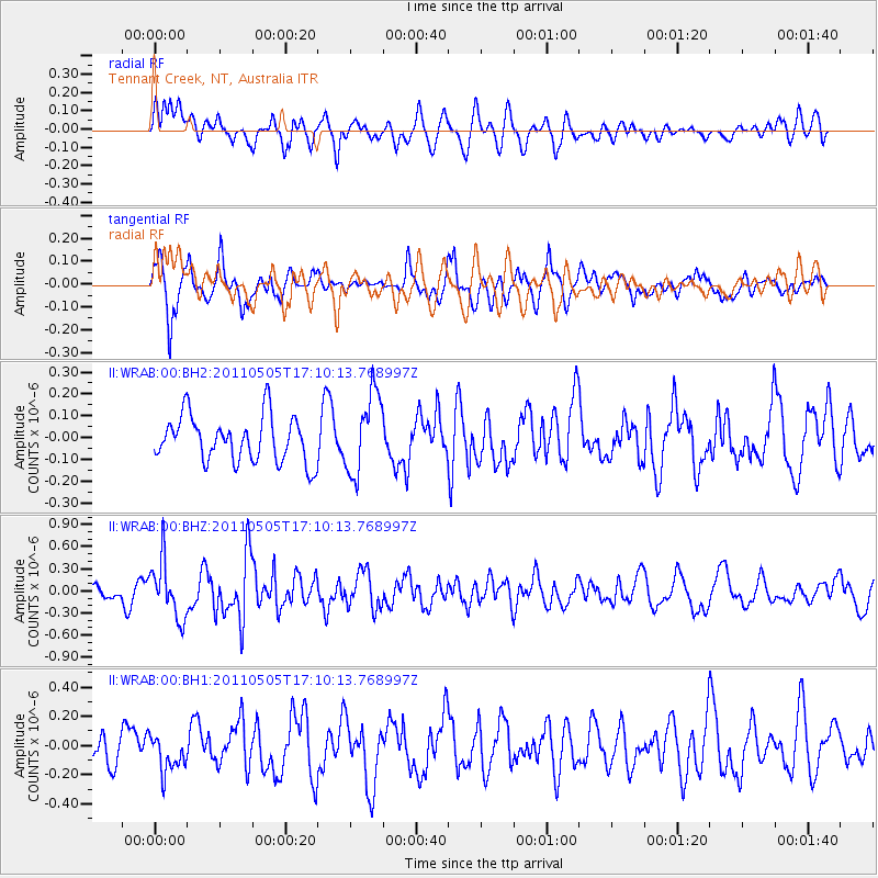
WRAB Tennant Creek, NT, Australia - Earthquake Result Viewer
*The percent match for this event was below the threshold and hence no stack was calculated.
| Earthquake location: |
Alaska Peninsula |
| Earthquake latitude/longitude: |
55.0/-160.7 |
| Earthquake time(UTC): |
2011/05/05 (125) 16:57:36 GMT |
| Earthquake Depth: |
36 km |
| Earthquake Magnitude: |
5.8 MW, 5.8 MW, 6.1 MB |
| Earthquake Catalog/Contributor: |
NEIC PDE/NEIC PDE-M |
|
| Network: |
II Global Seismograph Network (GSN - IRIS/IDA) |
| Station: |
WRAB Tennant Creek, NT, Australia |
| Lat/Lon: |
19.93 S/134.36 E |
| Elevation: |
366 m |
|
| Distance: |
92.7 deg |
| Az: |
238.573 deg |
| Baz: |
31.488 deg |
| Ray Param: |
$rayparam |
*The percent match for this event was below the threshold and hence was not used in the summary stack. |
|
| Radial Match: |
56.73011 % |
| Radial Bump: |
400 |
| Transverse Match: |
68.77461 % |
| Transverse Bump: |
400 |
| SOD ConfigId: |
558545 |
| Insert Time: |
2013-09-18 17:30:51.066 +0000 |
| GWidth: |
2.5 |
| Max Bumps: |
400 |
| Tol: |
0.001 |
|
Signal To Noise
| Channel | StoN | STA | LTA |
| II:WRAB:00:BHZ:20110505T17:10:13.768997Z | 2.0170028 | 3.879789E-7 | 1.9235416E-7 |
| II:WRAB:00:BH1:20110505T17:10:13.768997Z | 0.917529 | 1.2127894E-7 | 1.3217996E-7 |
| II:WRAB:00:BH2:20110505T17:10:13.768997Z | 1.7650658 | 1.8482191E-7 | 1.0471106E-7 |
| Arrivals |
| Ps | |
| PpPs | |
| PsPs/PpSs | |


