You are here: Home > Network List > IU - Global Seismograph Network (GSN - IRIS/USGS) Stations List
> Station HNR Honiara, Solomon Islands > Earthquake Result Viewer
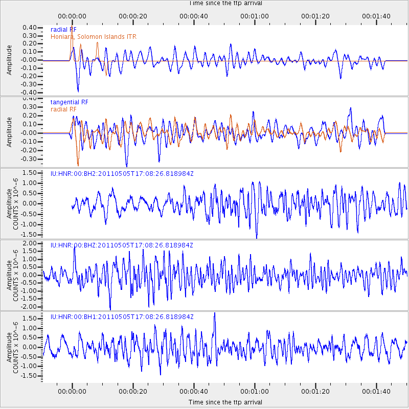
HNR Honiara, Solomon Islands - Earthquake Result Viewer
*The percent match for this event was below the threshold and hence no stack was calculated.
| Earthquake location: |
Alaska Peninsula |
| Earthquake latitude/longitude: |
55.0/-160.7 |
| Earthquake time(UTC): |
2011/05/05 (125) 16:57:36 GMT |
| Earthquake Depth: |
36 km |
| Earthquake Magnitude: |
5.8 MW, 5.8 MW, 6.1 MB |
| Earthquake Catalog/Contributor: |
NEIC PDE/NEIC PDE-M |
|
| Network: |
IU Global Seismograph Network (GSN - IRIS/USGS) |
| Station: |
HNR Honiara, Solomon Islands |
| Lat/Lon: |
9.44 S/159.95 E |
| Elevation: |
100 m |
|
| Distance: |
72.2 deg |
| Az: |
221.096 deg |
| Baz: |
22.561 deg |
| Ray Param: |
$rayparam |
*The percent match for this event was below the threshold and hence was not used in the summary stack. |
|
| Radial Match: |
66.70442 % |
| Radial Bump: |
400 |
| Transverse Match: |
58.95568 % |
| Transverse Bump: |
400 |
| SOD ConfigId: |
558545 |
| Insert Time: |
2013-09-18 17:31:13.169 +0000 |
| GWidth: |
2.5 |
| Max Bumps: |
400 |
| Tol: |
0.001 |
|
Signal To Noise
| Channel | StoN | STA | LTA |
| IU:HNR:00:BHZ:20110505T17:08:26.818984Z | 2.294553 | 6.305805E-7 | 2.7481624E-7 |
| IU:HNR:00:BH1:20110505T17:08:26.818984Z | 1.3065037 | 3.9397662E-7 | 3.0155036E-7 |
| IU:HNR:00:BH2:20110505T17:08:26.818984Z | 0.89581835 | 2.954925E-7 | 3.298576E-7 |
| Arrivals |
| Ps | |
| PpPs | |
| PsPs/PpSs | |


