You are here: Home > Network List > CN - Canadian National Seismograph Network Stations List
> Station INK INUVIK, NT > Earthquake Result Viewer
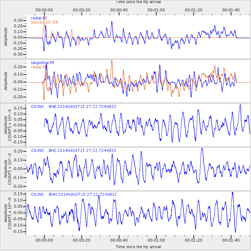
INK INUVIK, NT - Earthquake Result Viewer
*The percent match for this event was below the threshold and hence no stack was calculated.
| Earthquake location: |
Solomon Islands |
| Earthquake latitude/longitude: |
-11.0/162.1 |
| Earthquake time(UTC): |
2014/09/03 (246) 15:14:53 GMT |
| Earthquake Depth: |
36 km |
| Earthquake Magnitude: |
5.5 MW |
| Earthquake Catalog/Contributor: |
ISC/ISC |
|
| Network: |
CN Canadian National Seismograph Network |
| Station: |
INK INUVIK, NT |
| Lat/Lon: |
68.31 N/133.53 W |
| Elevation: |
44 m |
|
| Distance: |
91.0 deg |
| Az: |
19.598 deg |
| Baz: |
242.359 deg |
| Ray Param: |
$rayparam |
*The percent match for this event was below the threshold and hence was not used in the summary stack. |
|
| Radial Match: |
49.924904 % |
| Radial Bump: |
400 |
| Transverse Match: |
55.995403 % |
| Transverse Bump: |
400 |
| SOD ConfigId: |
3390531 |
| Insert Time: |
2019-04-13 19:53:11.655 +0000 |
| GWidth: |
2.5 |
| Max Bumps: |
400 |
| Tol: |
0.001 |
|
Signal To Noise
| Channel | StoN | STA | LTA |
| CN:INK: :BHZ:20140903T15:27:22.724983Z | 1.4139482 | 9.208961E-8 | 6.5129406E-8 |
| CN:INK: :BHN:20140903T15:27:22.724983Z | 1.0442355 | 5.1072192E-8 | 4.8908696E-8 |
| CN:INK: :BHE:20140903T15:27:22.724983Z | 0.9443734 | 4.6402672E-8 | 4.9135938E-8 |
| Arrivals |
| Ps | |
| PpPs | |
| PsPs/PpSs | |


