You are here: Home > Network List > US - United States National Seismic Network Stations List
> Station EGMT Eagleton, Montana, USA > Earthquake Result Viewer
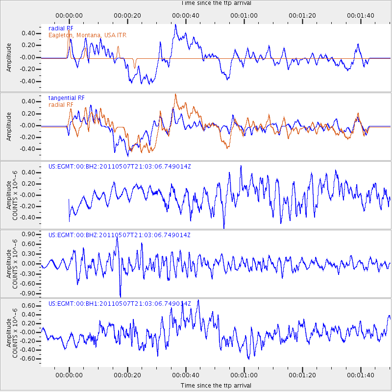
EGMT Eagleton, Montana, USA - Earthquake Result Viewer
*The percent match for this event was below the threshold and hence no stack was calculated.
| Earthquake location: |
Near East Coast Of Honshu, Japan |
| Earthquake latitude/longitude: |
40.2/142.2 |
| Earthquake time(UTC): |
2011/05/07 (127) 20:52:20 GMT |
| Earthquake Depth: |
35 km |
| Earthquake Magnitude: |
5.5 MB, 5.2 MS, 5.7 MW, 5.7 MW |
| Earthquake Catalog/Contributor: |
WHDF/NEIC |
|
| Network: |
US United States National Seismic Network |
| Station: |
EGMT Eagleton, Montana, USA |
| Lat/Lon: |
48.02 N/109.75 W |
| Elevation: |
1055 m |
|
| Distance: |
71.5 deg |
| Az: |
42.331 deg |
| Baz: |
309.834 deg |
| Ray Param: |
$rayparam |
*The percent match for this event was below the threshold and hence was not used in the summary stack. |
|
| Radial Match: |
38.357357 % |
| Radial Bump: |
400 |
| Transverse Match: |
48.893803 % |
| Transverse Bump: |
400 |
| SOD ConfigId: |
558545 |
| Insert Time: |
2013-09-18 17:39:26.308 +0000 |
| GWidth: |
2.5 |
| Max Bumps: |
400 |
| Tol: |
0.001 |
|
Signal To Noise
| Channel | StoN | STA | LTA |
| US:EGMT:00:BHZ:20110507T21:03:06.749014Z | 4.387724 | 2.9292016E-7 | 6.675903E-8 |
| US:EGMT:00:BH1:20110507T21:03:06.749014Z | 1.5675975 | 3.3470437E-7 | 2.1351423E-7 |
| US:EGMT:00:BH2:20110507T21:03:06.749014Z | 0.74907726 | 1.0964339E-7 | 1.4637126E-7 |
| Arrivals |
| Ps | |
| PpPs | |
| PsPs/PpSs | |


