You are here: Home > Network List > US - United States National Seismic Network Stations List
> Station HDIL Hopedale, Illinois, USA > Earthquake Result Viewer
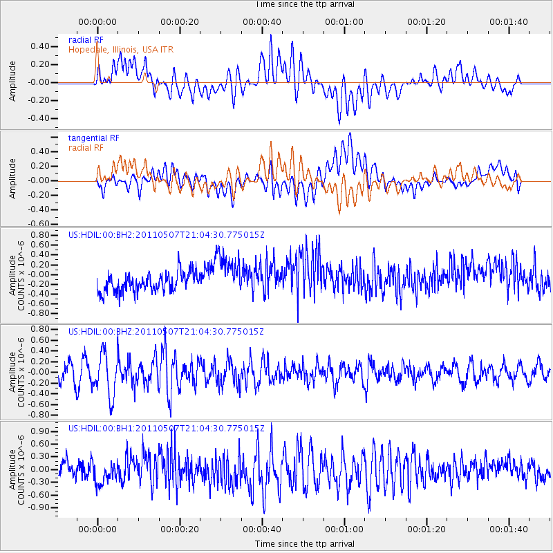
HDIL Hopedale, Illinois, USA - Earthquake Result Viewer
*The percent match for this event was below the threshold and hence no stack was calculated.
| Earthquake location: |
Near East Coast Of Honshu, Japan |
| Earthquake latitude/longitude: |
40.2/142.2 |
| Earthquake time(UTC): |
2011/05/07 (127) 20:52:20 GMT |
| Earthquake Depth: |
35 km |
| Earthquake Magnitude: |
5.5 MB, 5.2 MS, 5.7 MW, 5.7 MW |
| Earthquake Catalog/Contributor: |
WHDF/NEIC |
|
| Network: |
US United States National Seismic Network |
| Station: |
HDIL Hopedale, Illinois, USA |
| Lat/Lon: |
40.56 N/89.29 W |
| Elevation: |
219 m |
|
| Distance: |
86.9 deg |
| Az: |
36.688 deg |
| Baz: |
323.111 deg |
| Ray Param: |
$rayparam |
*The percent match for this event was below the threshold and hence was not used in the summary stack. |
|
| Radial Match: |
43.638947 % |
| Radial Bump: |
400 |
| Transverse Match: |
38.36065 % |
| Transverse Bump: |
400 |
| SOD ConfigId: |
558545 |
| Insert Time: |
2013-09-18 17:39:39.470 +0000 |
| GWidth: |
2.5 |
| Max Bumps: |
400 |
| Tol: |
0.001 |
|
Signal To Noise
| Channel | StoN | STA | LTA |
| US:HDIL:00:BHZ:20110507T21:04:30.775015Z | 2.5744019 | 4.0849545E-7 | 1.5867586E-7 |
| US:HDIL:00:BH1:20110507T21:04:30.775015Z | 1.3883804 | 2.5427678E-7 | 1.8314634E-7 |
| US:HDIL:00:BH2:20110507T21:04:30.775015Z | 2.3472028 | 4.4616996E-7 | 1.9008583E-7 |
| Arrivals |
| Ps | |
| PpPs | |
| PsPs/PpSs | |


