You are here: Home > Network List > II - Global Seismograph Network (GSN - IRIS/IDA) Stations List
> Station WRAB Tennant Creek, NT, Australia > Earthquake Result Viewer
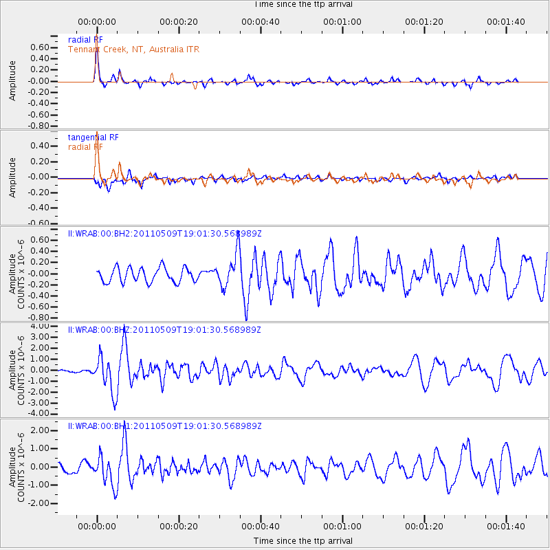
WRAB Tennant Creek, NT, Australia - Earthquake Result Viewer
*The percent match for this event was below the threshold and hence no stack was calculated.
| Earthquake location: |
West Of Macquarie Island |
| Earthquake latitude/longitude: |
-56.7/147.4 |
| Earthquake time(UTC): |
2011/05/09 (129) 18:54:43 GMT |
| Earthquake Depth: |
9.0 km |
| Earthquake Magnitude: |
5.7 MB, 5.7 MS, 6.1 MW, 5.9 MW |
| Earthquake Catalog/Contributor: |
WHDF/NEIC |
|
| Network: |
II Global Seismograph Network (GSN - IRIS/IDA) |
| Station: |
WRAB Tennant Creek, NT, Australia |
| Lat/Lon: |
19.93 S/134.36 E |
| Elevation: |
366 m |
|
| Distance: |
37.9 deg |
| Az: |
339.781 deg |
| Baz: |
168.293 deg |
| Ray Param: |
$rayparam |
*The percent match for this event was below the threshold and hence was not used in the summary stack. |
|
| Radial Match: |
75.66558 % |
| Radial Bump: |
316 |
| Transverse Match: |
63.19495 % |
| Transverse Bump: |
400 |
| SOD ConfigId: |
558545 |
| Insert Time: |
2013-09-18 17:41:23.205 +0000 |
| GWidth: |
2.5 |
| Max Bumps: |
400 |
| Tol: |
0.001 |
|
Signal To Noise
| Channel | StoN | STA | LTA |
| II:WRAB:00:BHZ:20110509T19:01:30.568989Z | 15.189798 | 1.677807E-6 | 1.1045617E-7 |
| II:WRAB:00:BH1:20110509T19:01:30.568989Z | 2.8560278 | 8.212683E-7 | 2.8755613E-7 |
| II:WRAB:00:BH2:20110509T19:01:30.568989Z | 2.494213 | 3.178191E-7 | 1.2742258E-7 |
| Arrivals |
| Ps | |
| PpPs | |
| PsPs/PpSs | |


