You are here: Home > Network List > IU - Global Seismograph Network (GSN - IRIS/USGS) Stations List
> Station HNR Honiara, Solomon Islands > Earthquake Result Viewer
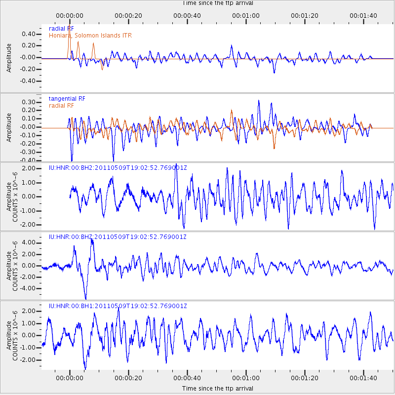
HNR Honiara, Solomon Islands - Earthquake Result Viewer
*The percent match for this event was below the threshold and hence no stack was calculated.
| Earthquake location: |
West Of Macquarie Island |
| Earthquake latitude/longitude: |
-56.7/147.4 |
| Earthquake time(UTC): |
2011/05/09 (129) 18:54:43 GMT |
| Earthquake Depth: |
9.0 km |
| Earthquake Magnitude: |
5.7 MB, 5.7 MS, 6.1 MW, 5.9 MW |
| Earthquake Catalog/Contributor: |
WHDF/NEIC |
|
| Network: |
IU Global Seismograph Network (GSN - IRIS/USGS) |
| Station: |
HNR Honiara, Solomon Islands |
| Lat/Lon: |
9.44 S/159.95 E |
| Elevation: |
100 m |
|
| Distance: |
48.1 deg |
| Az: |
16.721 deg |
| Baz: |
189.269 deg |
| Ray Param: |
$rayparam |
*The percent match for this event was below the threshold and hence was not used in the summary stack. |
|
| Radial Match: |
58.578342 % |
| Radial Bump: |
400 |
| Transverse Match: |
65.279305 % |
| Transverse Bump: |
400 |
| SOD ConfigId: |
558545 |
| Insert Time: |
2013-09-18 17:41:33.849 +0000 |
| GWidth: |
2.5 |
| Max Bumps: |
400 |
| Tol: |
0.001 |
|
Signal To Noise
| Channel | StoN | STA | LTA |
| IU:HNR:00:BHZ:20110509T19:02:52.769001Z | 3.6323085 | 1.5307573E-6 | 4.2142824E-7 |
| IU:HNR:00:BH1:20110509T19:02:52.769001Z | 0.8367596 | 7.240772E-7 | 8.653348E-7 |
| IU:HNR:00:BH2:20110509T19:02:52.769001Z | 0.8085577 | 4.980319E-7 | 6.1595097E-7 |
| Arrivals |
| Ps | |
| PpPs | |
| PsPs/PpSs | |


