You are here: Home > Network List > TA - USArray Transportable Network (new EarthScope stations) Stations List
> Station R11A Troy Canyon, Currant, NV, USA > Earthquake Result Viewer
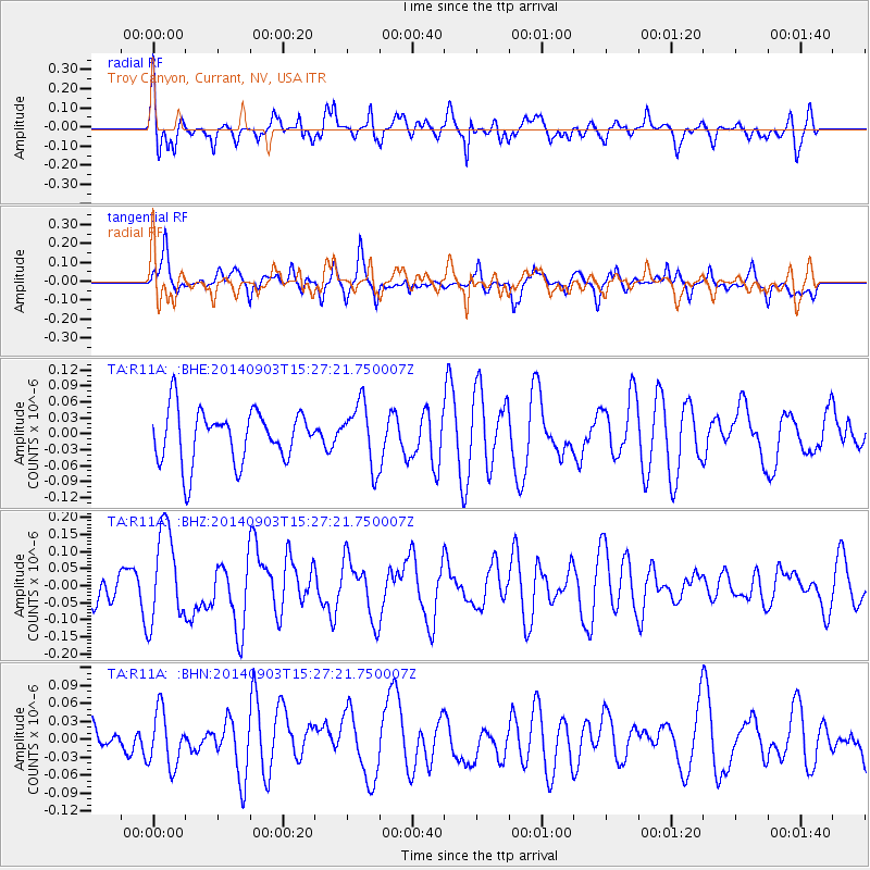
R11A Troy Canyon, Currant, NV, USA - Earthquake Result Viewer
*The percent match for this event was below the threshold and hence no stack was calculated.
| Earthquake location: |
Solomon Islands |
| Earthquake latitude/longitude: |
-11.0/162.1 |
| Earthquake time(UTC): |
2014/09/03 (246) 15:14:53 GMT |
| Earthquake Depth: |
36 km |
| Earthquake Magnitude: |
5.5 MW |
| Earthquake Catalog/Contributor: |
ISC/ISC |
|
| Network: |
TA USArray Transportable Network (new EarthScope stations) |
| Station: |
R11A Troy Canyon, Currant, NV, USA |
| Lat/Lon: |
38.35 N/115.59 W |
| Elevation: |
1756 m |
|
| Distance: |
90.8 deg |
| Az: |
51.204 deg |
| Baz: |
256.738 deg |
| Ray Param: |
$rayparam |
*The percent match for this event was below the threshold and hence was not used in the summary stack. |
|
| Radial Match: |
58.665848 % |
| Radial Bump: |
400 |
| Transverse Match: |
60.4464 % |
| Transverse Bump: |
400 |
| SOD ConfigId: |
3390531 |
| Insert Time: |
2019-04-13 19:54:40.366 +0000 |
| GWidth: |
2.5 |
| Max Bumps: |
400 |
| Tol: |
0.001 |
|
Signal To Noise
| Channel | StoN | STA | LTA |
| TA:R11A: :BHZ:20140903T15:27:21.750007Z | 3.0013704 | 1.3747106E-7 | 4.5802764E-8 |
| TA:R11A: :BHN:20140903T15:27:21.750007Z | 0.89203995 | 4.622547E-8 | 5.1819956E-8 |
| TA:R11A: :BHE:20140903T15:27:21.750007Z | 1.1934785 | 5.887386E-8 | 4.9329635E-8 |
| Arrivals |
| Ps | |
| PpPs | |
| PsPs/PpSs | |


