You are here: Home > Network List > US - United States National Seismic Network Stations List
> Station AMTX Amarillo, Texas, USA > Earthquake Result Viewer
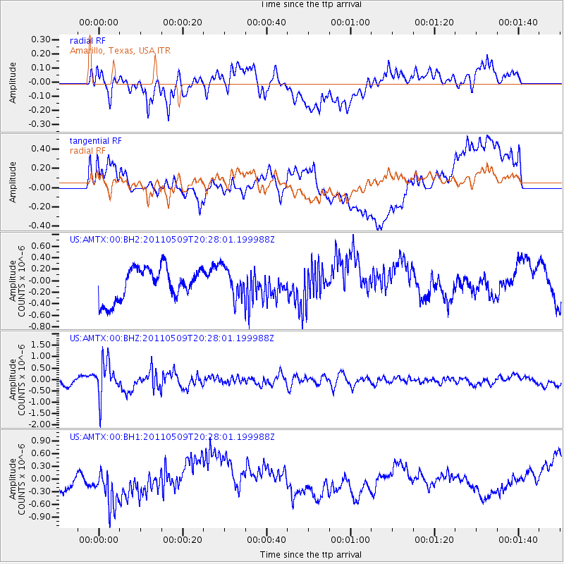
AMTX Amarillo, Texas, USA - Earthquake Result Viewer
*The percent match for this event was below the threshold and hence no stack was calculated.
| Earthquake location: |
Off East Coast Of Honshu, Japan |
| Earthquake latitude/longitude: |
37.7/143.5 |
| Earthquake time(UTC): |
2011/05/09 (129) 20:15:53 GMT |
| Earthquake Depth: |
10 km |
| Earthquake Magnitude: |
6.0 MB, 5.2 MS, 5.6 MW |
| Earthquake Catalog/Contributor: |
WHDF/NEIC |
|
| Network: |
US United States National Seismic Network |
| Station: |
AMTX Amarillo, Texas, USA |
| Lat/Lon: |
34.53 N/101.41 W |
| Elevation: |
1010 m |
|
| Distance: |
86.2 deg |
| Az: |
48.554 deg |
| Baz: |
313.961 deg |
| Ray Param: |
$rayparam |
*The percent match for this event was below the threshold and hence was not used in the summary stack. |
|
| Radial Match: |
50.06701 % |
| Radial Bump: |
400 |
| Transverse Match: |
50.78432 % |
| Transverse Bump: |
400 |
| SOD ConfigId: |
558545 |
| Insert Time: |
2013-09-18 17:44:53.558 +0000 |
| GWidth: |
2.5 |
| Max Bumps: |
400 |
| Tol: |
0.001 |
|
Signal To Noise
| Channel | StoN | STA | LTA |
| US:AMTX:00:BHZ:20110509T20:28:01.199988Z | 4.657258 | 7.6926244E-7 | 1.6517497E-7 |
| US:AMTX:00:BH1:20110509T20:28:01.199988Z | 1.7265912 | 4.850135E-7 | 2.8090813E-7 |
| US:AMTX:00:BH2:20110509T20:28:01.199988Z | 1.2808405 | 3.175887E-7 | 2.4795335E-7 |
| Arrivals |
| Ps | |
| PpPs | |
| PsPs/PpSs | |


