You are here: Home > Network List > US - United States National Seismic Network Stations List
> Station DUG Dugway, Tooele County, Utah, USA > Earthquake Result Viewer
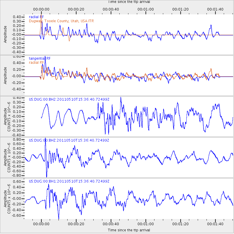
DUG Dugway, Tooele County, Utah, USA - Earthquake Result Viewer
*The percent match for this event was below the threshold and hence no stack was calculated.
| Earthquake location: |
E. Russia-N.E. China Border Reg. |
| Earthquake latitude/longitude: |
43.3/130.9 |
| Earthquake time(UTC): |
2011/05/10 (130) 15:26:04 GMT |
| Earthquake Depth: |
545 km |
| Earthquake Magnitude: |
5.7 MW |
| Earthquake Catalog/Contributor: |
NEIC PDE/NEIC PDE-M |
|
| Network: |
US United States National Seismic Network |
| Station: |
DUG Dugway, Tooele County, Utah, USA |
| Lat/Lon: |
40.19 N/112.81 W |
| Elevation: |
1477 m |
|
| Distance: |
78.9 deg |
| Az: |
44.428 deg |
| Baz: |
318.143 deg |
| Ray Param: |
$rayparam |
*The percent match for this event was below the threshold and hence was not used in the summary stack. |
|
| Radial Match: |
68.31785 % |
| Radial Bump: |
400 |
| Transverse Match: |
72.91758 % |
| Transverse Bump: |
400 |
| SOD ConfigId: |
558545 |
| Insert Time: |
2013-09-18 17:55:23.835 +0000 |
| GWidth: |
2.5 |
| Max Bumps: |
400 |
| Tol: |
0.001 |
|
Signal To Noise
| Channel | StoN | STA | LTA |
| US:DUG:00:BHZ:20110510T15:36:40.72499Z | 3.1010332 | 3.6242594E-7 | 1.1687264E-7 |
| US:DUG:00:BH1:20110510T15:36:40.72499Z | 2.1506877 | 2.1968397E-7 | 1.0214592E-7 |
| US:DUG:00:BH2:20110510T15:36:40.72499Z | 0.72418135 | 9.903989E-8 | 1.3676116E-7 |
| Arrivals |
| Ps | |
| PpPs | |
| PsPs/PpSs | |


