You are here: Home > Network List > US - United States National Seismic Network Stations List
> Station NEW Newport, Washington, USA > Earthquake Result Viewer
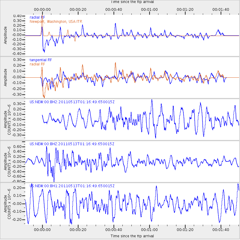
NEW Newport, Washington, USA - Earthquake Result Viewer
*The percent match for this event was below the threshold and hence no stack was calculated.
| Earthquake location: |
South Of Mariana Islands |
| Earthquake latitude/longitude: |
12.4/144.0 |
| Earthquake time(UTC): |
2011/05/13 (133) 01:04:36 GMT |
| Earthquake Depth: |
5.8 km |
| Earthquake Magnitude: |
5.5 MW, 5.5 MW, 5.6 MB |
| Earthquake Catalog/Contributor: |
NEIC PDE/NEIC PDE-M |
|
| Network: |
US United States National Seismic Network |
| Station: |
NEW Newport, Washington, USA |
| Lat/Lon: |
48.26 N/117.12 W |
| Elevation: |
760 m |
|
| Distance: |
86.7 deg |
| Az: |
41.398 deg |
| Baz: |
284.817 deg |
| Ray Param: |
$rayparam |
*The percent match for this event was below the threshold and hence was not used in the summary stack. |
|
| Radial Match: |
66.54095 % |
| Radial Bump: |
400 |
| Transverse Match: |
49.67034 % |
| Transverse Bump: |
400 |
| SOD ConfigId: |
558545 |
| Insert Time: |
2013-09-18 18:06:32.637 +0000 |
| GWidth: |
2.5 |
| Max Bumps: |
400 |
| Tol: |
0.001 |
|
Signal To Noise
| Channel | StoN | STA | LTA |
| US:NEW:00:BHZ:20110513T01:16:49.650015Z | 2.336767 | 2.5743867E-7 | 1.1016874E-7 |
| US:NEW:00:BH1:20110513T01:16:49.650015Z | 1.3497437 | 1.4679381E-7 | 1.087568E-7 |
| US:NEW:00:BH2:20110513T01:16:49.650015Z | 1.1268575 | 1.0046286E-7 | 8.9153126E-8 |
| Arrivals |
| Ps | |
| PpPs | |
| PsPs/PpSs | |


