You are here: Home > Network List > US - United States National Seismic Network Stations List
> Station HAWA Hanford, Washington, USA > Earthquake Result Viewer
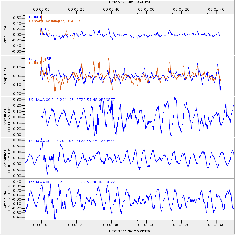
HAWA Hanford, Washington, USA - Earthquake Result Viewer
*The percent match for this event was below the threshold and hence no stack was calculated.
| Earthquake location: |
Costa Rica |
| Earthquake latitude/longitude: |
10.0/-84.3 |
| Earthquake time(UTC): |
2011/05/13 (133) 22:47:54 GMT |
| Earthquake Depth: |
73 km |
| Earthquake Magnitude: |
5.6 MB, 5.9 MW, 6.0 MW |
| Earthquake Catalog/Contributor: |
WHDF/NEIC |
|
| Network: |
US United States National Seismic Network |
| Station: |
HAWA Hanford, Washington, USA |
| Lat/Lon: |
46.39 N/119.53 W |
| Elevation: |
364 m |
|
| Distance: |
47.1 deg |
| Az: |
326.969 deg |
| Baz: |
129.118 deg |
| Ray Param: |
$rayparam |
*The percent match for this event was below the threshold and hence was not used in the summary stack. |
|
| Radial Match: |
60.056164 % |
| Radial Bump: |
400 |
| Transverse Match: |
80.02784 % |
| Transverse Bump: |
400 |
| SOD ConfigId: |
558545 |
| Insert Time: |
2013-09-18 18:09:51.993 +0000 |
| GWidth: |
2.5 |
| Max Bumps: |
400 |
| Tol: |
0.001 |
|
Signal To Noise
| Channel | StoN | STA | LTA |
| US:HAWA:00:BHZ:20110513T22:55:48.023987Z | 2.276248 | 4.803068E-7 | 2.1100816E-7 |
| US:HAWA:00:BH1:20110513T22:55:48.023987Z | 1.5689104 | 2.1066646E-7 | 1.3427565E-7 |
| US:HAWA:00:BH2:20110513T22:55:48.023987Z | 2.1823797 | 1.9489745E-7 | 8.930501E-8 |
| Arrivals |
| Ps | |
| PpPs | |
| PsPs/PpSs | |


