You are here: Home > Network List > US - United States National Seismic Network Stations List
> Station MSO Missoula, Montana, USA > Earthquake Result Viewer
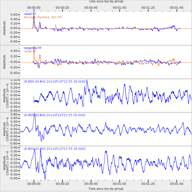
MSO Missoula, Montana, USA - Earthquake Result Viewer
*The percent match for this event was below the threshold and hence no stack was calculated.
| Earthquake location: |
Costa Rica |
| Earthquake latitude/longitude: |
10.0/-84.3 |
| Earthquake time(UTC): |
2011/05/13 (133) 22:47:54 GMT |
| Earthquake Depth: |
73 km |
| Earthquake Magnitude: |
5.6 MB, 5.9 MW, 6.0 MW |
| Earthquake Catalog/Contributor: |
WHDF/NEIC |
|
| Network: |
US United States National Seismic Network |
| Station: |
MSO Missoula, Montana, USA |
| Lat/Lon: |
46.83 N/113.94 W |
| Elevation: |
1264 m |
|
| Distance: |
44.5 deg |
| Az: |
331.054 deg |
| Baz: |
136.019 deg |
| Ray Param: |
$rayparam |
*The percent match for this event was below the threshold and hence was not used in the summary stack. |
|
| Radial Match: |
59.642242 % |
| Radial Bump: |
367 |
| Transverse Match: |
38.808037 % |
| Transverse Bump: |
400 |
| SOD ConfigId: |
558545 |
| Insert Time: |
2013-09-18 18:10:19.006 +0000 |
| GWidth: |
2.5 |
| Max Bumps: |
400 |
| Tol: |
0.001 |
|
Signal To Noise
| Channel | StoN | STA | LTA |
| US:MSO:00:BHZ:20110513T22:55:28.000Z | 3.609642 | 3.9843664E-7 | 1.1038121E-7 |
| US:MSO:00:BH1:20110513T22:55:28.000Z | 4.2378526 | 2.12104E-7 | 5.0049874E-8 |
| US:MSO:00:BH2:20110513T22:55:28.000Z | 1.1380076 | 1.0503109E-7 | 9.229383E-8 |
| Arrivals |
| Ps | |
| PpPs | |
| PsPs/PpSs | |


