You are here: Home > Network List > US - United States National Seismic Network Stations List
> Station AMTX Amarillo, Texas, USA > Earthquake Result Viewer
AMTX Amarillo, Texas, USA - Earthquake Result Viewer
*The percent match for this event was below the threshold and hence no stack was calculated.
| Earthquake location: |
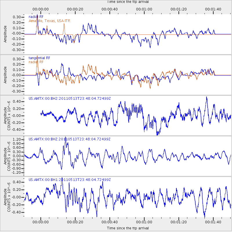
Near East Coast Of Honshu, Japan |
| Earthquake latitude/longitude: |
37.4/141.3 |
| Earthquake time(UTC): |
2011/05/13 (133) 23:35:52 GMT |
| Earthquake Depth: |
35 km |
| Earthquake Magnitude: |
5.6 MB, 5.7 MS, 6.1 MW, 5.9 MW |
| Earthquake Catalog/Contributor: |
WHDF/NEIC |
|
| Network: |
US United States National Seismic Network |
| Station: |
AMTX Amarillo, Texas, USA |
| Lat/Lon: |
34.53 N/101.41 W |
| Elevation: |
1010 m |
|
| Distance: |
87.7 deg |
| Az: |
47.27 deg |
| Baz: |
314.879 deg |
| Ray Param: |
$rayparam |
*The percent match for this event was below the threshold and hence was not used in the summary stack. |
|
| Radial Match: |
56.984123 % |
| Radial Bump: |
400 |
| Transverse Match: |
47.23191 % |
| Transverse Bump: |
400 |
| SOD ConfigId: |
558545 |
| Insert Time: |
2013-09-18 18:12:46.597 +0000 |
| GWidth: |
2.5 |
| Max Bumps: |
400 |
| Tol: |
0.001 |
|
Signal To Noise
| Channel | StoN | STA | LTA |
| US:AMTX:00:BHZ:20110513T23:48:04.72499Z | 3.1154356 | 3.7362162E-7 | 1.1992596E-7 |
| US:AMTX:00:BH1:20110513T23:48:04.72499Z | 1.4491452 | 2.0834194E-7 | 1.4376884E-7 |
| US:AMTX:00:BH2:20110513T23:48:04.72499Z | 1.3078759 | 1.4361268E-7 | 1.09806045E-7 |
| Arrivals |
| Ps | |
| PpPs | |
| PsPs/PpSs | |


