You are here: Home > Network List > US - United States National Seismic Network Stations List
> Station ERPA Erie, Pennsylvania, USA > Earthquake Result Viewer
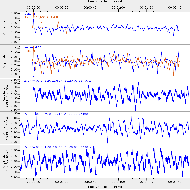
ERPA Erie, Pennsylvania, USA - Earthquake Result Viewer
*The percent match for this event was below the threshold and hence no stack was calculated.
| Earthquake location: |
Hindu Kush Region, Afghanistan |
| Earthquake latitude/longitude: |
36.4/70.7 |
| Earthquake time(UTC): |
2011/05/14 (134) 21:07:22 GMT |
| Earthquake Depth: |
207 km |
| Earthquake Magnitude: |
5.8 MB, 6.0 MW, 6.0 MW |
| Earthquake Catalog/Contributor: |
WHDF/NEIC |
|
| Network: |
US United States National Seismic Network |
| Station: |
ERPA Erie, Pennsylvania, USA |
| Lat/Lon: |
42.12 N/79.99 W |
| Elevation: |
306 m |
|
| Distance: |
97.4 deg |
| Az: |
338.486 deg |
| Baz: |
23.431 deg |
| Ray Param: |
$rayparam |
*The percent match for this event was below the threshold and hence was not used in the summary stack. |
|
| Radial Match: |
45.36756 % |
| Radial Bump: |
383 |
| Transverse Match: |
43.85392 % |
| Transverse Bump: |
377 |
| SOD ConfigId: |
558545 |
| Insert Time: |
2013-09-18 18:16:23.545 +0000 |
| GWidth: |
2.5 |
| Max Bumps: |
400 |
| Tol: |
0.001 |
|
Signal To Noise
| Channel | StoN | STA | LTA |
| US:ERPA:00:BHZ:20110514T21:20:00.324001Z | 1.849374 | 2.817899E-7 | 1.5237043E-7 |
| US:ERPA:00:BH1:20110514T21:20:00.324001Z | 0.9106317 | 1.293943E-7 | 1.420929E-7 |
| US:ERPA:00:BH2:20110514T21:20:00.324001Z | 0.7142063 | 6.930433E-8 | 9.703685E-8 |
| Arrivals |
| Ps | |
| PpPs | |
| PsPs/PpSs | |


