You are here: Home > Network List > US - United States National Seismic Network Stations List
> Station AMTX Amarillo, Texas, USA > Earthquake Result Viewer
AMTX Amarillo, Texas, USA - Earthquake Result Viewer
*The percent match for this event was below the threshold and hence no stack was calculated.
| Earthquake location: |
Central Mid-Atlantic Ridge |
| Earthquake latitude/longitude: |
0.6/-25.6 |
| Earthquake time(UTC): |
2011/05/15 (135) 13:08:13 GMT |
| Earthquake Depth: |
10 km |
| Earthquake Magnitude: |
5.6 MB, 5.4 MS, 6.1 MW, 6.1 MW |
| Earthquake Catalog/Contributor: |
WHDF/NEIC |
|
| Network: |
US United States National Seismic Network |
| Station: |
AMTX Amarillo, Texas, USA |
| Lat/Lon: |
34.53 N/101.41 W |
| Elevation: |
1010 m |
|
| Distance: |
78.0 deg |
| Az: |
305.091 deg |
| Baz: |
97.676 deg |
| Ray Param: |
$rayparam |
*The percent match for this event was below the threshold and hence was not used in the summary stack. |
|
| Radial Match: |
56.62506 % |
| Radial Bump: |
400 |
| Transverse Match: |
46.608116 % |
| Transverse Bump: |
400 |
| SOD ConfigId: |
558545 |
| Insert Time: |
2013-09-18 18:20:08.303 +0000 |
| GWidth: |
2.5 |
| Max Bumps: |
400 |
| Tol: |
0.001 |
|
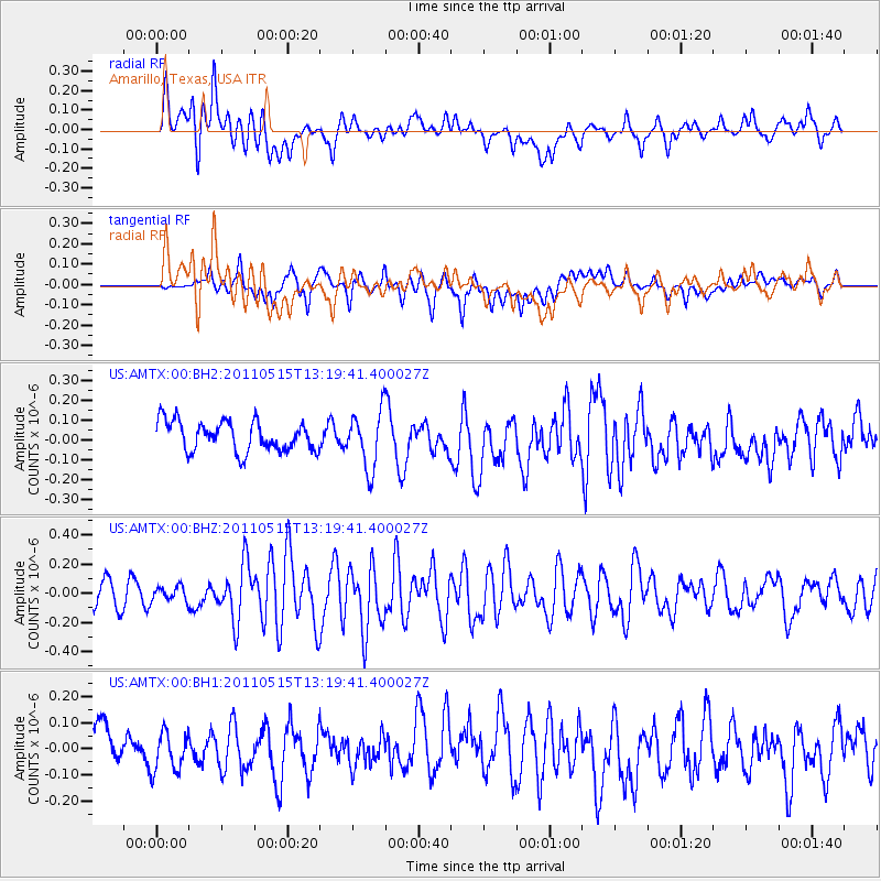
Signal To Noise
| Channel | StoN | STA | LTA |
| US:AMTX:00:BHZ:20110515T13:19:41.400027Z | 0.5345746 | 5.0284715E-8 | 9.4064916E-8 |
| US:AMTX:00:BH1:20110515T13:19:41.400027Z | 0.7109174 | 7.330824E-8 | 1.031178E-7 |
| US:AMTX:00:BH2:20110515T13:19:41.400027Z | 1.7107087 | 1.2753627E-7 | 7.4551714E-8 |
| Arrivals |
| Ps | |
| PpPs | |
| PsPs/PpSs | |


