You are here: Home > Network List > US - United States National Seismic Network Stations List
> Station BOZ Bozeman, Montana, USA > Earthquake Result Viewer
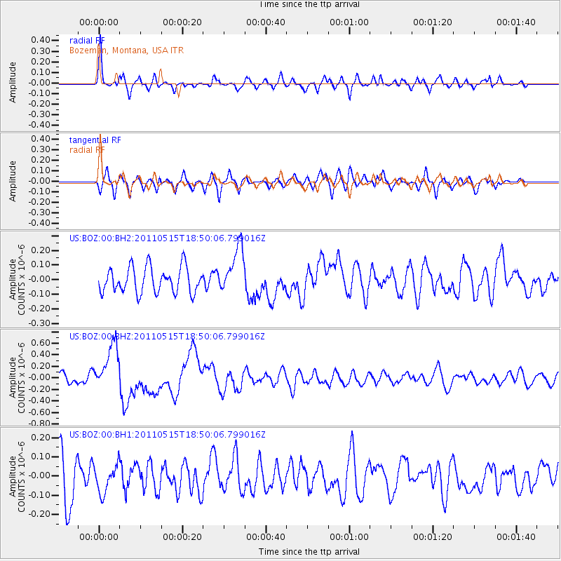
BOZ Bozeman, Montana, USA - Earthquake Result Viewer
*The percent match for this event was below the threshold and hence no stack was calculated.
| Earthquake location: |
Solomon Islands |
| Earthquake latitude/longitude: |
-6.1/154.4 |
| Earthquake time(UTC): |
2011/05/15 (135) 18:37:10 GMT |
| Earthquake Depth: |
40 km |
| Earthquake Magnitude: |
6.3 MB, 6.2 MS, 6.5 MW, 6.5 MW |
| Earthquake Catalog/Contributor: |
WHDF/NEIC |
|
| Network: |
US United States National Seismic Network |
| Station: |
BOZ Bozeman, Montana, USA |
| Lat/Lon: |
45.65 N/111.63 W |
| Elevation: |
1589 m |
|
| Distance: |
97.1 deg |
| Az: |
44.845 deg |
| Baz: |
268.545 deg |
| Ray Param: |
$rayparam |
*The percent match for this event was below the threshold and hence was not used in the summary stack. |
|
| Radial Match: |
75.49204 % |
| Radial Bump: |
400 |
| Transverse Match: |
65.70534 % |
| Transverse Bump: |
400 |
| SOD ConfigId: |
558545 |
| Insert Time: |
2013-09-18 18:22:47.884 +0000 |
| GWidth: |
2.5 |
| Max Bumps: |
400 |
| Tol: |
0.001 |
|
Signal To Noise
| Channel | StoN | STA | LTA |
| US:BOZ:00:BHZ:20110515T18:50:06.799016Z | 4.2042146 | 4.1472603E-7 | 9.86453E-8 |
| US:BOZ:00:BH1:20110515T18:50:06.799016Z | 0.69484943 | 7.292232E-8 | 1.0494694E-7 |
| US:BOZ:00:BH2:20110515T18:50:06.799016Z | 1.8918285 | 1.6529218E-7 | 8.737165E-8 |
| Arrivals |
| Ps | |
| PpPs | |
| PsPs/PpSs | |


