You are here: Home > Network List > US - United States National Seismic Network Stations List
> Station MSO Missoula, Montana, USA > Earthquake Result Viewer
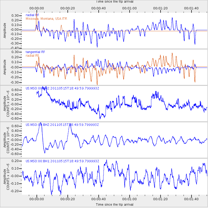
MSO Missoula, Montana, USA - Earthquake Result Viewer
*The percent match for this event was below the threshold and hence no stack was calculated.
| Earthquake location: |
Solomon Islands |
| Earthquake latitude/longitude: |
-6.1/154.4 |
| Earthquake time(UTC): |
2011/05/15 (135) 18:37:10 GMT |
| Earthquake Depth: |
40 km |
| Earthquake Magnitude: |
6.3 MB, 6.2 MS, 6.5 MW, 6.5 MW |
| Earthquake Catalog/Contributor: |
WHDF/NEIC |
|
| Network: |
US United States National Seismic Network |
| Station: |
MSO Missoula, Montana, USA |
| Lat/Lon: |
46.83 N/113.94 W |
| Elevation: |
1264 m |
|
| Distance: |
95.5 deg |
| Az: |
43.594 deg |
| Baz: |
267.019 deg |
| Ray Param: |
$rayparam |
*The percent match for this event was below the threshold and hence was not used in the summary stack. |
|
| Radial Match: |
29.546104 % |
| Radial Bump: |
400 |
| Transverse Match: |
37.58886 % |
| Transverse Bump: |
400 |
| SOD ConfigId: |
558545 |
| Insert Time: |
2013-09-18 18:23:01.051 +0000 |
| GWidth: |
2.5 |
| Max Bumps: |
400 |
| Tol: |
0.001 |
|
Signal To Noise
| Channel | StoN | STA | LTA |
| US:MSO:00:BHZ:20110515T18:49:59.799993Z | 5.085276 | 4.6305206E-7 | 9.10574E-8 |
| US:MSO:00:BH1:20110515T18:49:59.799993Z | 1.0716063 | 1.2967423E-7 | 1.2100921E-7 |
| US:MSO:00:BH2:20110515T18:49:59.799993Z | 0.78308976 | 2.0689569E-7 | 2.6420432E-7 |
| Arrivals |
| Ps | |
| PpPs | |
| PsPs/PpSs | |


