You are here: Home > Network List > TA - USArray Transportable Network (new EarthScope stations) Stations List
> Station Z41A Richland Creek Farm, El Dorado, AR, USA > Earthquake Result Viewer
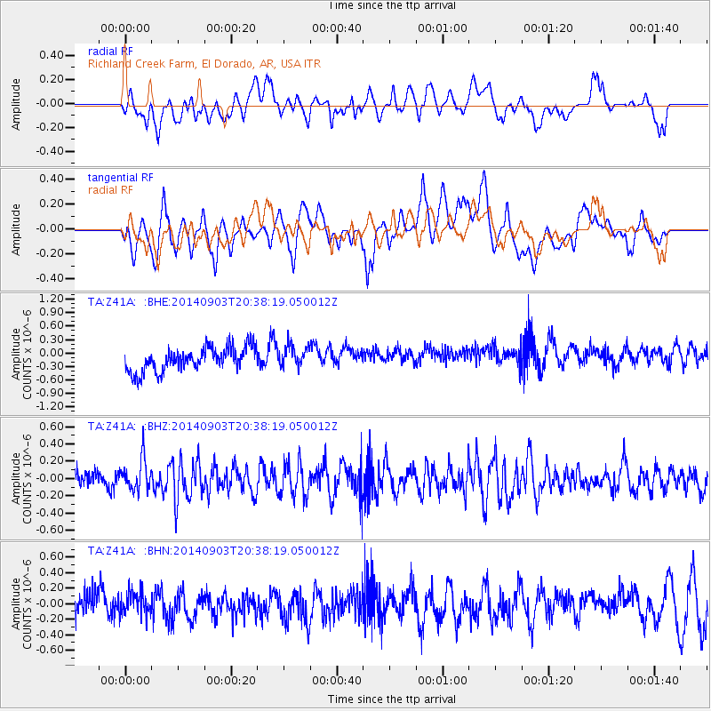
Z41A Richland Creek Farm, El Dorado, AR, USA - Earthquake Result Viewer
*The percent match for this event was below the threshold and hence no stack was calculated.
| Earthquake location: |
Easter Island Region |
| Earthquake latitude/longitude: |
-26.6/-115.0 |
| Earthquake time(UTC): |
2014/09/03 (246) 20:28:22 GMT |
| Earthquake Depth: |
10 km |
| Earthquake Magnitude: |
5.5 MW |
| Earthquake Catalog/Contributor: |
ISC/ISC |
|
| Network: |
TA USArray Transportable Network (new EarthScope stations) |
| Station: |
Z41A Richland Creek Farm, El Dorado, AR, USA |
| Lat/Lon: |
33.26 N/92.80 W |
| Elevation: |
62 m |
|
| Distance: |
63.1 deg |
| Az: |
20.769 deg |
| Baz: |
202.27 deg |
| Ray Param: |
$rayparam |
*The percent match for this event was below the threshold and hence was not used in the summary stack. |
|
| Radial Match: |
36.340385 % |
| Radial Bump: |
400 |
| Transverse Match: |
52.901295 % |
| Transverse Bump: |
400 |
| SOD ConfigId: |
3390531 |
| Insert Time: |
2019-04-13 20:03:24.681 +0000 |
| GWidth: |
2.5 |
| Max Bumps: |
400 |
| Tol: |
0.001 |
|
Signal To Noise
| Channel | StoN | STA | LTA |
| TA:Z41A: :BHZ:20140903T20:38:19.050012Z | 1.3622272 | 1.8201459E-7 | 1.3361544E-7 |
| TA:Z41A: :BHN:20140903T20:38:19.050012Z | 0.7926153 | 1.4911336E-7 | 1.8812828E-7 |
| TA:Z41A: :BHE:20140903T20:38:19.050012Z | 0.8933664 | 2.3510033E-7 | 2.6316226E-7 |
| Arrivals |
| Ps | |
| PpPs | |
| PsPs/PpSs | |


