You are here: Home > Network List > US - United States National Seismic Network Stations List
> Station HDIL Hopedale, Illinois, USA > Earthquake Result Viewer
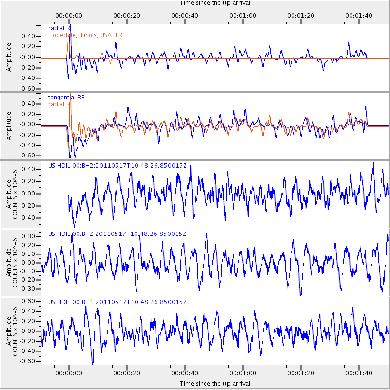
HDIL Hopedale, Illinois, USA - Earthquake Result Viewer
*The percent match for this event was below the threshold and hence no stack was calculated.
| Earthquake location: |
Tonga Islands |
| Earthquake latitude/longitude: |
-15.6/-175.2 |
| Earthquake time(UTC): |
2011/05/17 (137) 10:35:26 GMT |
| Earthquake Depth: |
10 km |
| Earthquake Magnitude: |
5.7 MW, 5.6 MW |
| Earthquake Catalog/Contributor: |
NEIC PDE/NEIC PDE-M |
|
| Network: |
US United States National Seismic Network |
| Station: |
HDIL Hopedale, Illinois, USA |
| Lat/Lon: |
40.56 N/89.29 W |
| Elevation: |
219 m |
|
| Distance: |
97.0 deg |
| Az: |
49.966 deg |
| Baz: |
255.501 deg |
| Ray Param: |
$rayparam |
*The percent match for this event was below the threshold and hence was not used in the summary stack. |
|
| Radial Match: |
56.837852 % |
| Radial Bump: |
400 |
| Transverse Match: |
36.677685 % |
| Transverse Bump: |
400 |
| SOD ConfigId: |
558545 |
| Insert Time: |
2013-09-18 18:29:37.021 +0000 |
| GWidth: |
2.5 |
| Max Bumps: |
400 |
| Tol: |
0.001 |
|
Signal To Noise
| Channel | StoN | STA | LTA |
| US:HDIL:00:BHZ:20110517T10:48:26.850015Z | 1.2767226 | 1.677659E-7 | 1.3140357E-7 |
| US:HDIL:00:BH1:20110517T10:48:26.850015Z | 1.1829267 | 2.0933192E-7 | 1.7696102E-7 |
| US:HDIL:00:BH2:20110517T10:48:26.850015Z | 0.7493766 | 1.4765492E-7 | 1.97037E-7 |
| Arrivals |
| Ps | |
| PpPs | |
| PsPs/PpSs | |


