You are here: Home > Network List > US - United States National Seismic Network Stations List
> Station MIAR Mount Ida, Arkansas, USA > Earthquake Result Viewer
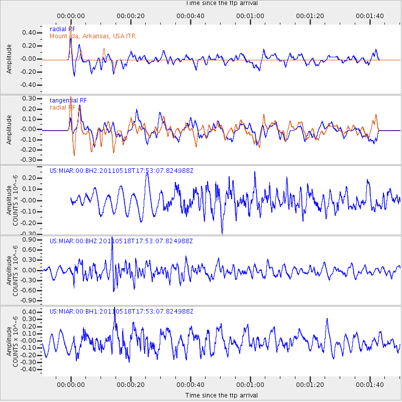
MIAR Mount Ida, Arkansas, USA - Earthquake Result Viewer
*The percent match for this event was below the threshold and hence no stack was calculated.
| Earthquake location: |
Off East Coast Of Kamchatka |
| Earthquake latitude/longitude: |
55.5/163.8 |
| Earthquake time(UTC): |
2011/05/18 (138) 17:42:35 GMT |
| Earthquake Depth: |
14 km |
| Earthquake Magnitude: |
5.5 MW, 5.5 MW, 5.6 MB |
| Earthquake Catalog/Contributor: |
NEIC PDE/NEIC PDE-M |
|
| Network: |
US United States National Seismic Network |
| Station: |
MIAR Mount Ida, Arkansas, USA |
| Lat/Lon: |
34.55 N/93.58 W |
| Elevation: |
207 m |
|
| Distance: |
68.8 deg |
| Az: |
59.802 deg |
| Baz: |
323.456 deg |
| Ray Param: |
$rayparam |
*The percent match for this event was below the threshold and hence was not used in the summary stack. |
|
| Radial Match: |
63.81452 % |
| Radial Bump: |
400 |
| Transverse Match: |
43.021797 % |
| Transverse Bump: |
400 |
| SOD ConfigId: |
558545 |
| Insert Time: |
2013-09-18 18:33:25.306 +0000 |
| GWidth: |
2.5 |
| Max Bumps: |
400 |
| Tol: |
0.001 |
|
Signal To Noise
| Channel | StoN | STA | LTA |
| US:MIAR:00:BHZ:20110518T17:53:07.824988Z | 1.4055618 | 1.9295793E-7 | 1.372817E-7 |
| US:MIAR:00:BH1:20110518T17:53:07.824988Z | 1.278121 | 1.4164722E-7 | 1.1082459E-7 |
| US:MIAR:00:BH2:20110518T17:53:07.824988Z | 0.7099055 | 5.355511E-8 | 7.5439765E-8 |
| Arrivals |
| Ps | |
| PpPs | |
| PsPs/PpSs | |


