You are here: Home > Network List > US - United States National Seismic Network Stations List
> Station MNTX Cornudas Mountains, Texas, USA > Earthquake Result Viewer
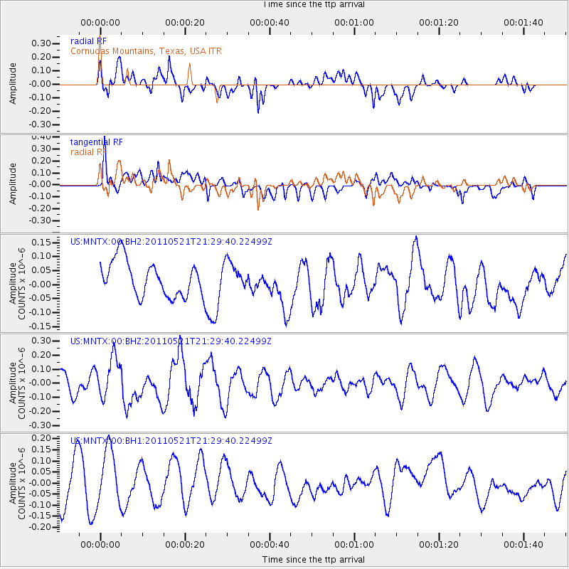
MNTX Cornudas Mountains, Texas, USA - Earthquake Result Viewer
*The percent match for this event was below the threshold and hence no stack was calculated.
| Earthquake location: |
Kermadec Islands, New Zealand |
| Earthquake latitude/longitude: |
-30.8/-178.2 |
| Earthquake time(UTC): |
2011/05/21 (141) 21:17:02 GMT |
| Earthquake Depth: |
34 km |
| Earthquake Magnitude: |
5.5 MB, 5.4 MS, 5.8 MW, 5.8 MW |
| Earthquake Catalog/Contributor: |
WHDF/NEIC |
|
| Network: |
US United States National Seismic Network |
| Station: |
MNTX Cornudas Mountains, Texas, USA |
| Lat/Lon: |
31.70 N/105.38 W |
| Elevation: |
404 m |
|
| Distance: |
92.8 deg |
| Az: |
54.61 deg |
| Baz: |
235.362 deg |
| Ray Param: |
$rayparam |
*The percent match for this event was below the threshold and hence was not used in the summary stack. |
|
| Radial Match: |
65.5754 % |
| Radial Bump: |
400 |
| Transverse Match: |
56.839977 % |
| Transverse Bump: |
400 |
| SOD ConfigId: |
558545 |
| Insert Time: |
2013-09-18 18:46:51.652 +0000 |
| GWidth: |
2.5 |
| Max Bumps: |
400 |
| Tol: |
0.001 |
|
Signal To Noise
| Channel | StoN | STA | LTA |
| US:MNTX:00:BHZ:20110521T21:29:40.22499Z | 0.7923521 | 1.458221E-7 | 1.8403699E-7 |
| US:MNTX:00:BH1:20110521T21:29:40.22499Z | 1.2161013 | 1.2840515E-7 | 1.05587546E-7 |
| US:MNTX:00:BH2:20110521T21:29:40.22499Z | 0.78877056 | 4.9461192E-8 | 6.270669E-8 |
| Arrivals |
| Ps | |
| PpPs | |
| PsPs/PpSs | |


