You are here: Home > Network List > US - United States National Seismic Network Stations List
> Station AMTX Amarillo, Texas, USA > Earthquake Result Viewer
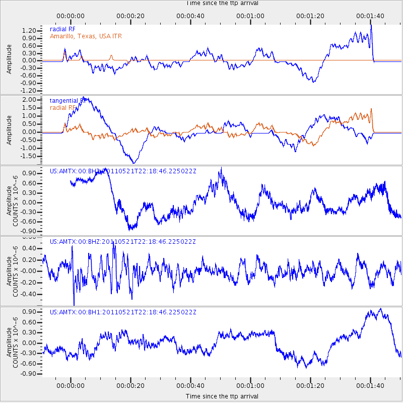
AMTX Amarillo, Texas, USA - Earthquake Result Viewer
*The percent match for this event was below the threshold and hence no stack was calculated.
| Earthquake location: |
Near East Coast Of Honshu, Japan |
| Earthquake latitude/longitude: |
35.6/140.5 |
| Earthquake time(UTC): |
2011/05/21 (141) 22:06:26 GMT |
| Earthquake Depth: |
37 km |
| Earthquake Magnitude: |
5.5 MB, 5.0 MS, 5.5 MW, 5.6 MW |
| Earthquake Catalog/Contributor: |
WHDF/NEIC |
|
| Network: |
US United States National Seismic Network |
| Station: |
AMTX Amarillo, Texas, USA |
| Lat/Lon: |
34.53 N/101.41 W |
| Elevation: |
1010 m |
|
| Distance: |
89.4 deg |
| Az: |
46.746 deg |
| Baz: |
314.032 deg |
| Ray Param: |
$rayparam |
*The percent match for this event was below the threshold and hence was not used in the summary stack. |
|
| Radial Match: |
38.335957 % |
| Radial Bump: |
400 |
| Transverse Match: |
42.807922 % |
| Transverse Bump: |
400 |
| SOD ConfigId: |
558545 |
| Insert Time: |
2013-09-18 18:48:40.154 +0000 |
| GWidth: |
2.5 |
| Max Bumps: |
400 |
| Tol: |
0.001 |
|
Signal To Noise
| Channel | StoN | STA | LTA |
| US:AMTX:00:BHZ:20110521T22:18:46.225022Z | 2.0275753 | 2.1740495E-7 | 1.0722411E-7 |
| US:AMTX:00:BH1:20110521T22:18:46.225022Z | 0.90629506 | 4.6018874E-7 | 5.0776924E-7 |
| US:AMTX:00:BH2:20110521T22:18:46.225022Z | 1.013053 | 6.0792695E-7 | 6.0009387E-7 |
| Arrivals |
| Ps | |
| PpPs | |
| PsPs/PpSs | |


