You are here: Home > Network List > US - United States National Seismic Network Stations List
> Station EGMT Eagleton, Montana, USA > Earthquake Result Viewer
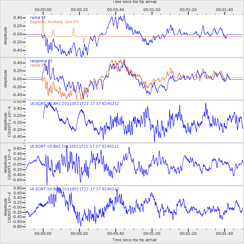
EGMT Eagleton, Montana, USA - Earthquake Result Viewer
*The percent match for this event was below the threshold and hence no stack was calculated.
| Earthquake location: |
Near East Coast Of Honshu, Japan |
| Earthquake latitude/longitude: |
35.6/140.5 |
| Earthquake time(UTC): |
2011/05/21 (141) 22:06:26 GMT |
| Earthquake Depth: |
37 km |
| Earthquake Magnitude: |
5.5 MB, 5.0 MS, 5.5 MW, 5.6 MW |
| Earthquake Catalog/Contributor: |
WHDF/NEIC |
|
| Network: |
US United States National Seismic Network |
| Station: |
EGMT Eagleton, Montana, USA |
| Lat/Lon: |
48.02 N/109.75 W |
| Elevation: |
1055 m |
|
| Distance: |
75.8 deg |
| Az: |
40.662 deg |
| Baz: |
307.716 deg |
| Ray Param: |
$rayparam |
*The percent match for this event was below the threshold and hence was not used in the summary stack. |
|
| Radial Match: |
72.851654 % |
| Radial Bump: |
400 |
| Transverse Match: |
80.54138 % |
| Transverse Bump: |
400 |
| SOD ConfigId: |
558545 |
| Insert Time: |
2013-09-18 18:48:53.641 +0000 |
| GWidth: |
2.5 |
| Max Bumps: |
400 |
| Tol: |
0.001 |
|
Signal To Noise
| Channel | StoN | STA | LTA |
| US:EGMT:00:BHZ:20110521T22:17:37.824021Z | 1.1058491 | 2.2632388E-7 | 2.0466072E-7 |
| US:EGMT:00:BH1:20110521T22:17:37.824021Z | 2.4674659 | 5.196625E-7 | 2.1060573E-7 |
| US:EGMT:00:BH2:20110521T22:17:37.824021Z | 1.7859849 | 4.0358267E-7 | 2.2597206E-7 |
| Arrivals |
| Ps | |
| PpPs | |
| PsPs/PpSs | |


