You are here: Home > Network List > GS - US Geological Survey Networks Stations List
> Station KAN13 Rinehart Farm > Earthquake Result Viewer
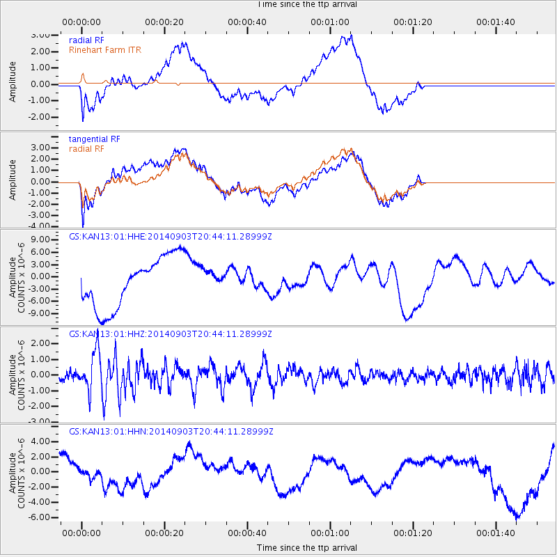
KAN13 Rinehart Farm - Earthquake Result Viewer
*The percent match for this event was below the threshold and hence no stack was calculated.
| Earthquake location: |
Easter Island Region |
| Earthquake latitude/longitude: |
-26.5/-114.6 |
| Earthquake time(UTC): |
2014/09/03 (246) 20:34:00 GMT |
| Earthquake Depth: |
10 km |
| Earthquake Magnitude: |
5.9 MWB |
| Earthquake Catalog/Contributor: |
NEIC PDE/NEIC COMCAT |
|
| Network: |
GS US Geological Survey Networks |
| Station: |
KAN13 Rinehart Farm |
| Lat/Lon: |
37.01 N/97.48 W |
| Elevation: |
340 m |
|
| Distance: |
65.3 deg |
| Az: |
15.065 deg |
| Baz: |
196.909 deg |
| Ray Param: |
$rayparam |
*The percent match for this event was below the threshold and hence was not used in the summary stack. |
|
| Radial Match: |
39.687782 % |
| Radial Bump: |
400 |
| Transverse Match: |
28.911598 % |
| Transverse Bump: |
400 |
| SOD ConfigId: |
3390531 |
| Insert Time: |
2019-04-13 20:08:23.793 +0000 |
| GWidth: |
2.5 |
| Max Bumps: |
400 |
| Tol: |
0.001 |
|
Signal To Noise
| Channel | StoN | STA | LTA |
| GS:KAN13:01:HHZ:20140903T20:44:11.28999Z | 4.5172715 | 1.2611802E-6 | 2.791907E-7 |
| GS:KAN13:01:HHN:20140903T20:44:11.28999Z | 0.35540175 | 7.309211E-7 | 2.0566054E-6 |
| GS:KAN13:01:HHE:20140903T20:44:11.28999Z | 0.4258932 | 2.5832385E-6 | 6.065461E-6 |
| Arrivals |
| Ps | |
| PpPs | |
| PsPs/PpSs | |


