You are here: Home > Network List > US - United States National Seismic Network Stations List
> Station MIAR Mount Ida, Arkansas, USA > Earthquake Result Viewer
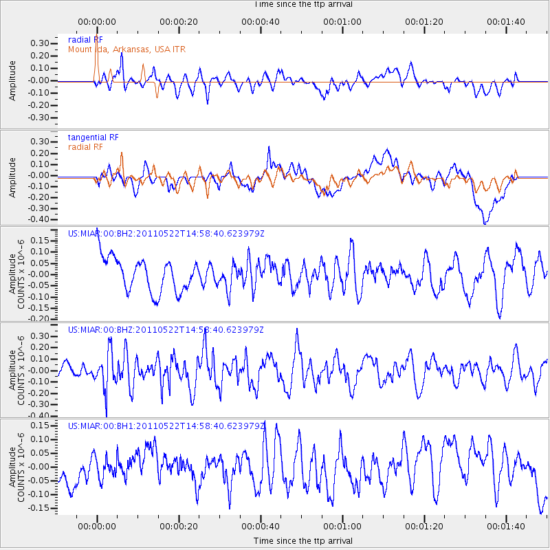
MIAR Mount Ida, Arkansas, USA - Earthquake Result Viewer
*The percent match for this event was below the threshold and hence no stack was calculated.
| Earthquake location: |
Off East Coast Of Honshu, Japan |
| Earthquake latitude/longitude: |
37.6/143.5 |
| Earthquake time(UTC): |
2011/05/22 (142) 14:46:11 GMT |
| Earthquake Depth: |
29 km |
| Earthquake Magnitude: |
5.6 MW, 5.5 MB, 5.6 MW |
| Earthquake Catalog/Contributor: |
NEIC PDE/NEIC PDE-M |
|
| Network: |
US United States National Seismic Network |
| Station: |
MIAR Mount Ida, Arkansas, USA |
| Lat/Lon: |
34.55 N/93.58 W |
| Elevation: |
207 m |
|
| Distance: |
90.8 deg |
| Az: |
43.856 deg |
| Baz: |
318.19 deg |
| Ray Param: |
$rayparam |
*The percent match for this event was below the threshold and hence was not used in the summary stack. |
|
| Radial Match: |
46.004395 % |
| Radial Bump: |
400 |
| Transverse Match: |
36.379322 % |
| Transverse Bump: |
400 |
| SOD ConfigId: |
558545 |
| Insert Time: |
2013-09-18 18:52:15.523 +0000 |
| GWidth: |
2.5 |
| Max Bumps: |
400 |
| Tol: |
0.001 |
|
Signal To Noise
| Channel | StoN | STA | LTA |
| US:MIAR:00:BHZ:20110522T14:58:40.623979Z | 2.6255465 | 1.5970342E-7 | 6.082673E-8 |
| US:MIAR:00:BH1:20110522T14:58:40.623979Z | 0.38174117 | 3.8080106E-8 | 9.9753734E-8 |
| US:MIAR:00:BH2:20110522T14:58:40.623979Z | 0.7270624 | 5.4493995E-8 | 7.495092E-8 |
| Arrivals |
| Ps | |
| PpPs | |
| PsPs/PpSs | |


