You are here: Home > Network List > US - United States National Seismic Network Stations List
> Station HAWA Hanford, Washington, USA > Earthquake Result Viewer
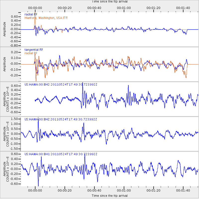
HAWA Hanford, Washington, USA - Earthquake Result Viewer
*The percent match for this event was below the threshold and hence no stack was calculated.
| Earthquake location: |
Andreanof Islands, Aleutian Is. |
| Earthquake latitude/longitude: |
52.6/-173.3 |
| Earthquake time(UTC): |
2011/05/24 (144) 17:43:24 GMT |
| Earthquake Depth: |
138 km |
| Earthquake Magnitude: |
5.6 MB, 5.5 MW, 5.5 MW |
| Earthquake Catalog/Contributor: |
WHDF/NEIC |
|
| Network: |
US United States National Seismic Network |
| Station: |
HAWA Hanford, Washington, USA |
| Lat/Lon: |
46.39 N/119.53 W |
| Elevation: |
364 m |
|
| Distance: |
34.7 deg |
| Az: |
78.279 deg |
| Baz: |
300.35 deg |
| Ray Param: |
$rayparam |
*The percent match for this event was below the threshold and hence was not used in the summary stack. |
|
| Radial Match: |
48.63775 % |
| Radial Bump: |
400 |
| Transverse Match: |
51.09591 % |
| Transverse Bump: |
400 |
| SOD ConfigId: |
558545 |
| Insert Time: |
2013-09-18 18:59:40.540 +0000 |
| GWidth: |
2.5 |
| Max Bumps: |
400 |
| Tol: |
0.001 |
|
Signal To Noise
| Channel | StoN | STA | LTA |
| US:HAWA:00:BHZ:20110524T17:49:30.723992Z | 3.266299 | 4.892538E-7 | 1.4978842E-7 |
| US:HAWA:00:BH1:20110524T17:49:30.723992Z | 1.9732482 | 2.2084768E-7 | 1.1192088E-7 |
| US:HAWA:00:BH2:20110524T17:49:30.723992Z | 3.190714 | 2.6224373E-7 | 8.218967E-8 |
| Arrivals |
| Ps | |
| PpPs | |
| PsPs/PpSs | |


