You are here: Home > Network List > US - United States National Seismic Network Stations List
> Station MSO Missoula, Montana, USA > Earthquake Result Viewer
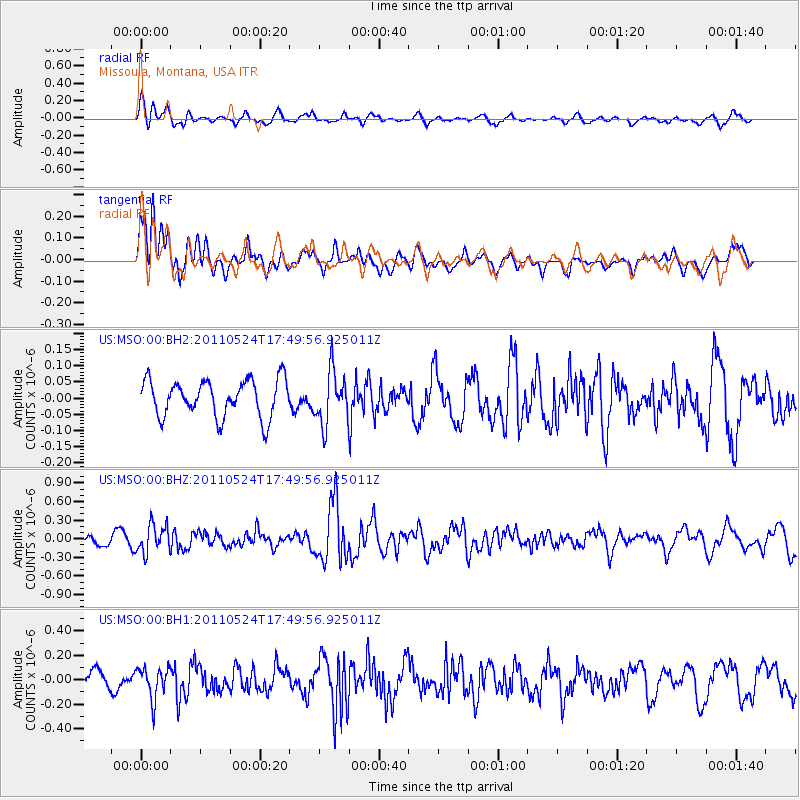
MSO Missoula, Montana, USA - Earthquake Result Viewer
*The percent match for this event was below the threshold and hence no stack was calculated.
| Earthquake location: |
Andreanof Islands, Aleutian Is. |
| Earthquake latitude/longitude: |
52.6/-173.3 |
| Earthquake time(UTC): |
2011/05/24 (144) 17:43:24 GMT |
| Earthquake Depth: |
138 km |
| Earthquake Magnitude: |
5.6 MB, 5.5 MW, 5.5 MW |
| Earthquake Catalog/Contributor: |
WHDF/NEIC |
|
| Network: |
US United States National Seismic Network |
| Station: |
MSO Missoula, Montana, USA |
| Lat/Lon: |
46.83 N/113.94 W |
| Elevation: |
1264 m |
|
| Distance: |
37.8 deg |
| Az: |
74.312 deg |
| Baz: |
301.204 deg |
| Ray Param: |
$rayparam |
*The percent match for this event was below the threshold and hence was not used in the summary stack. |
|
| Radial Match: |
62.7503 % |
| Radial Bump: |
400 |
| Transverse Match: |
58.18636 % |
| Transverse Bump: |
400 |
| SOD ConfigId: |
558545 |
| Insert Time: |
2013-09-18 19:00:04.262 +0000 |
| GWidth: |
2.5 |
| Max Bumps: |
400 |
| Tol: |
0.001 |
|
Signal To Noise
| Channel | StoN | STA | LTA |
| US:MSO:00:BHZ:20110524T17:49:56.925011Z | 2.861898 | 2.2370354E-7 | 7.8166146E-8 |
| US:MSO:00:BH1:20110524T17:49:56.925011Z | 1.989111 | 1.281698E-7 | 6.4435724E-8 |
| US:MSO:00:BH2:20110524T17:49:56.925011Z | 1.4396892 | 8.137765E-8 | 5.6524456E-8 |
| Arrivals |
| Ps | |
| PpPs | |
| PsPs/PpSs | |


