You are here: Home > Network List > IU - Global Seismograph Network (GSN - IRIS/USGS) Stations List
> Station POHA Pohakuloa, Hawaii, USA > Earthquake Result Viewer
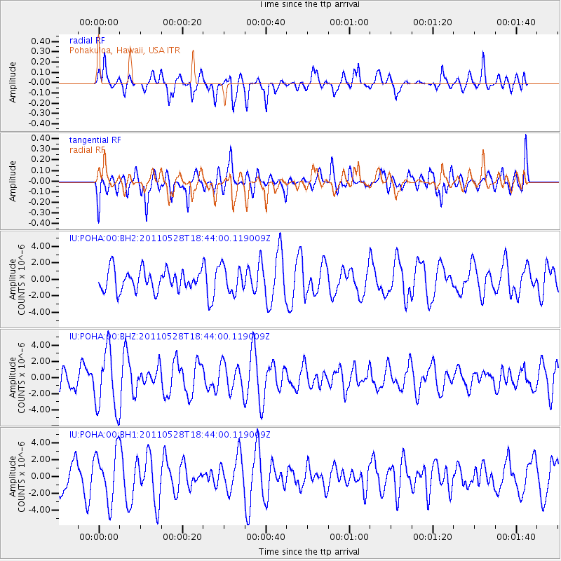
POHA Pohakuloa, Hawaii, USA - Earthquake Result Viewer
*The percent match for this event was below the threshold and hence no stack was calculated.
| Earthquake location: |
Kermadec Islands Region |
| Earthquake latitude/longitude: |
-27.5/-178.5 |
| Earthquake time(UTC): |
2011/05/28 (148) 18:35:52 GMT |
| Earthquake Depth: |
307 km |
| Earthquake Magnitude: |
5.5 MW, 5.3 MB |
| Earthquake Catalog/Contributor: |
WHDF/NEIC |
|
| Network: |
IU Global Seismograph Network (GSN - IRIS/USGS) |
| Station: |
POHA Pohakuloa, Hawaii, USA |
| Lat/Lon: |
19.76 N/155.53 W |
| Elevation: |
1990 m |
|
| Distance: |
52.0 deg |
| Az: |
27.855 deg |
| Baz: |
206.154 deg |
| Ray Param: |
$rayparam |
*The percent match for this event was below the threshold and hence was not used in the summary stack. |
|
| Radial Match: |
69.77623 % |
| Radial Bump: |
400 |
| Transverse Match: |
61.31608 % |
| Transverse Bump: |
400 |
| SOD ConfigId: |
558545 |
| Insert Time: |
2013-09-18 19:03:18.378 +0000 |
| GWidth: |
2.5 |
| Max Bumps: |
400 |
| Tol: |
0.001 |
|
Signal To Noise
| Channel | StoN | STA | LTA |
| IU:POHA:00:BHZ:20110528T18:44:00.119009Z | 1.8914516 | 3.871975E-6 | 2.0470918E-6 |
| IU:POHA:00:BH1:20110528T18:44:00.119009Z | 1.7646337 | 3.0049637E-6 | 1.7028824E-6 |
| IU:POHA:00:BH2:20110528T18:44:00.119009Z | 1.2780372 | 1.5635853E-6 | 1.2234271E-6 |
| Arrivals |
| Ps | |
| PpPs | |
| PsPs/PpSs | |


