You are here: Home > Network List > II - Global Seismograph Network (GSN - IRIS/IDA) Stations List
> Station WRAB Tennant Creek, NT, Australia > Earthquake Result Viewer
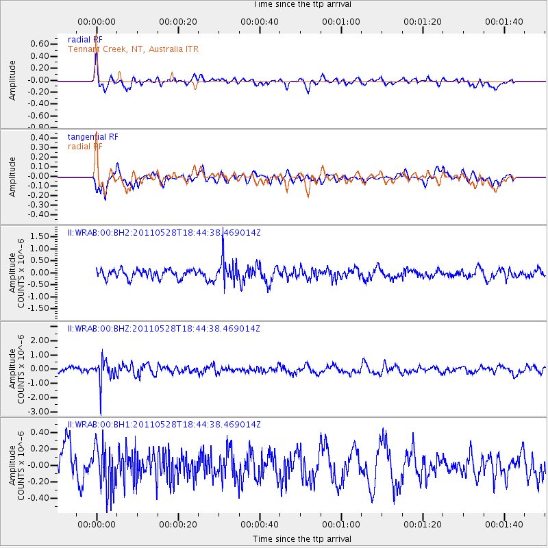
WRAB Tennant Creek, NT, Australia - Earthquake Result Viewer
*The percent match for this event was below the threshold and hence no stack was calculated.
| Earthquake location: |
Kermadec Islands Region |
| Earthquake latitude/longitude: |
-27.3/-178.5 |
| Earthquake time(UTC): |
2011/05/28 (148) 18:37:34 GMT |
| Earthquake Depth: |
307 km |
| Earthquake Magnitude: |
5.5 MW |
| Earthquake Catalog/Contributor: |
NEIC PDE/NEIC PDE-M |
|
| Network: |
II Global Seismograph Network (GSN - IRIS/IDA) |
| Station: |
WRAB Tennant Creek, NT, Australia |
| Lat/Lon: |
19.93 S/134.36 E |
| Elevation: |
366 m |
|
| Distance: |
43.6 deg |
| Az: |
269.17 deg |
| Baz: |
108.902 deg |
| Ray Param: |
$rayparam |
*The percent match for this event was below the threshold and hence was not used in the summary stack. |
|
| Radial Match: |
62.10025 % |
| Radial Bump: |
400 |
| Transverse Match: |
67.44013 % |
| Transverse Bump: |
400 |
| SOD ConfigId: |
558545 |
| Insert Time: |
2013-09-18 19:04:25.464 +0000 |
| GWidth: |
2.5 |
| Max Bumps: |
400 |
| Tol: |
0.001 |
|
Signal To Noise
| Channel | StoN | STA | LTA |
| II:WRAB:00:BHZ:20110528T18:44:38.469014Z | 3.1016984 | 7.709018E-7 | 2.4854185E-7 |
| II:WRAB:00:BH1:20110528T18:44:38.469014Z | 0.9895704 | 2.765934E-7 | 2.7950858E-7 |
| II:WRAB:00:BH2:20110528T18:44:38.469014Z | 2.809999 | 4.980175E-7 | 1.7723052E-7 |
| Arrivals |
| Ps | |
| PpPs | |
| PsPs/PpSs | |


