You are here: Home > Network List > IU - Global Seismograph Network (GSN - IRIS/USGS) Stations List
> Station HNR Honiara, Solomon Islands > Earthquake Result Viewer
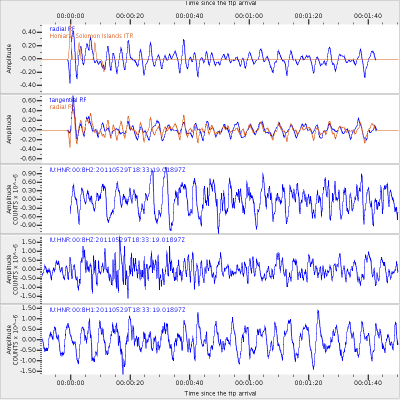
HNR Honiara, Solomon Islands - Earthquake Result Viewer
*The percent match for this event was below the threshold and hence no stack was calculated.
| Earthquake location: |
Southwest Of Sumatra, Indonesia |
| Earthquake latitude/longitude: |
-7.7/101.8 |
| Earthquake time(UTC): |
2011/05/29 (149) 18:24:01 GMT |
| Earthquake Depth: |
13 km |
| Earthquake Magnitude: |
5.6 MB, 5.4 MS, 5.9 MW, 5.8 MW |
| Earthquake Catalog/Contributor: |
WHDF/NEIC |
|
| Network: |
IU Global Seismograph Network (GSN - IRIS/USGS) |
| Station: |
HNR Honiara, Solomon Islands |
| Lat/Lon: |
9.44 S/159.95 E |
| Elevation: |
100 m |
|
| Distance: |
57.5 deg |
| Az: |
96.269 deg |
| Baz: |
266.842 deg |
| Ray Param: |
$rayparam |
*The percent match for this event was below the threshold and hence was not used in the summary stack. |
|
| Radial Match: |
58.04179 % |
| Radial Bump: |
400 |
| Transverse Match: |
63.086414 % |
| Transverse Bump: |
400 |
| SOD ConfigId: |
558545 |
| Insert Time: |
2013-09-18 19:07:29.693 +0000 |
| GWidth: |
2.5 |
| Max Bumps: |
400 |
| Tol: |
0.001 |
|
Signal To Noise
| Channel | StoN | STA | LTA |
| IU:HNR:00:BHZ:20110529T18:33:19.01897Z | 2.206697 | 6.298238E-7 | 2.8541467E-7 |
| IU:HNR:00:BH1:20110529T18:33:19.01897Z | 1.762961 | 5.3872816E-7 | 3.0558144E-7 |
| IU:HNR:00:BH2:20110529T18:33:19.01897Z | 2.1571808 | 7.16261E-7 | 3.3203568E-7 |
| Arrivals |
| Ps | |
| PpPs | |
| PsPs/PpSs | |


