GNI Garni, Armenia - Earthquake Result Viewer
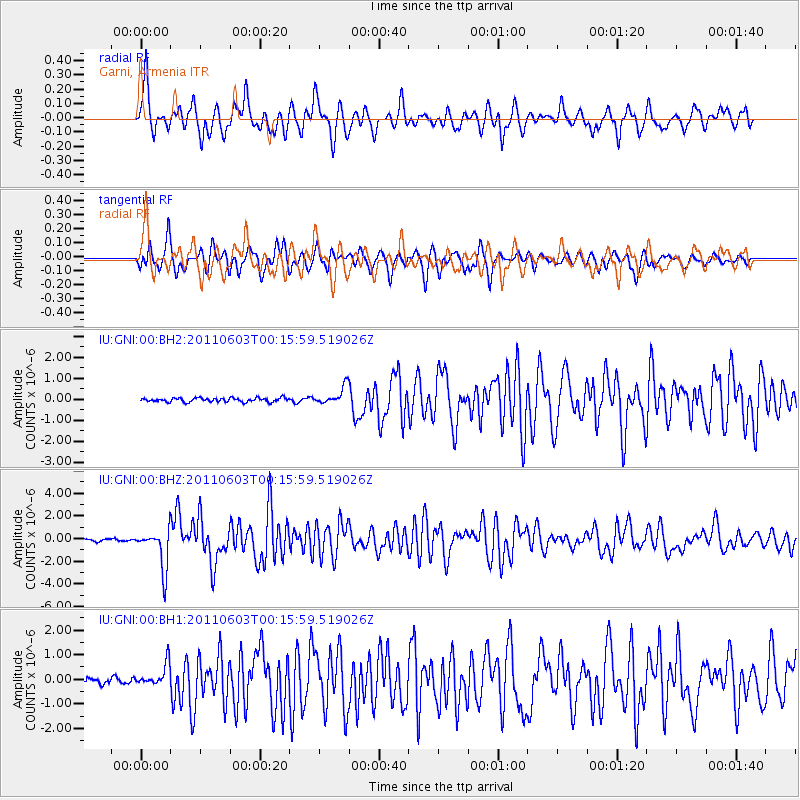
Earthquake location: Off East Coast Of Honshu, Japan
Earthquake latitude/longitude: 37.3/143.9
Earthquake time(UTC): 2011/06/03 (154) 00:05:00 GMT
Earthquake Depth: 14 km
Earthquake Magnitude: 6.2 MW, 5.9 MS, 6.1 MW, 6.4 MB
Earthquake Catalog/Contributor: NEIC PDE/NEIC PDE-M
Network: IU Global Seismograph Network (GSN - IRIS/USGS)
Station: GNI Garni, Armenia
Lat/Lon: 40.15 N/44.74 E
Elevation: 1609 m
Distance: 73.1 deg
Az: 307.749 deg
Baz: 55.362 deg
Ray Param: 0.053191345
Estimated Moho Depth: 37.25 km
Estimated Crust Vp/Vs: 2.08
Assumed Crust Vp: 6.291 km/s
Estimated Crust Vs: 3.024 km/s
Estimated Crust Poisson's Ratio: 0.35
Radial Match: 84.92336 %
Radial Bump: 400
Transverse Match: 79.82497 %
Transverse Bump: 400
SOD ConfigId: 558545
Insert Time: 2013-09-18 19:12:58.317 +0000
GWidth: 2.5
Max Bumps: 400
Tol: 0.001

Signal To Noise

ChannelStoNSTALTA
IU:GNI:00:BHZ:20110603T00:15:59.519026Z20.2287451.7678869E-68.7394795E-8
IU:GNI:00:BH1:20110603T00:15:59.519026Z4.40368274.6134468E-71.0476338E-7
IU:GNI:00:BH2:20110603T00:15:59.519026Z4.3954944.13057E-79.397282E-8
Arrivals
Ps6.6 SECOND
PpPs18 SECOND
PsPs/PpSs24 SECOND