You are here: Home > Network List > US - United States National Seismic Network Stations List
> Station EGMT Eagleton, Montana, USA > Earthquake Result Viewer
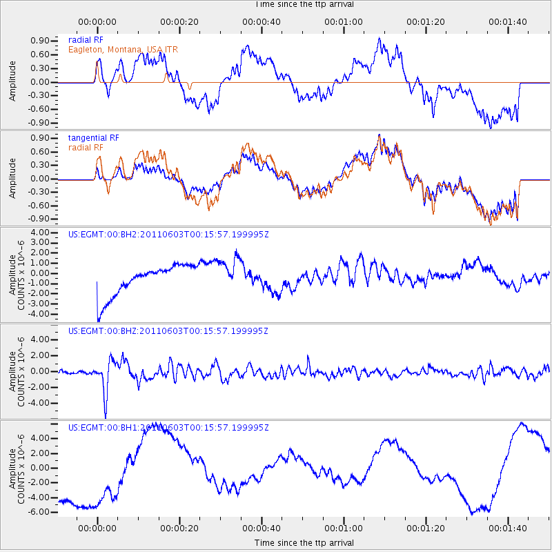
EGMT Eagleton, Montana, USA - Earthquake Result Viewer
*The percent match for this event was below the threshold and hence no stack was calculated.
| Earthquake location: |
Off East Coast Of Honshu, Japan |
| Earthquake latitude/longitude: |
37.3/143.9 |
| Earthquake time(UTC): |
2011/06/03 (154) 00:05:00 GMT |
| Earthquake Depth: |
14 km |
| Earthquake Magnitude: |
6.2 MW, 5.9 MS, 6.1 MW, 6.4 MB |
| Earthquake Catalog/Contributor: |
NEIC PDE/NEIC PDE-M |
|
| Network: |
US United States National Seismic Network |
| Station: |
EGMT Eagleton, Montana, USA |
| Lat/Lon: |
48.02 N/109.75 W |
| Elevation: |
1055 m |
|
| Distance: |
72.8 deg |
| Az: |
42.416 deg |
| Baz: |
306.735 deg |
| Ray Param: |
$rayparam |
*The percent match for this event was below the threshold and hence was not used in the summary stack. |
|
| Radial Match: |
23.045214 % |
| Radial Bump: |
400 |
| Transverse Match: |
20.590416 % |
| Transverse Bump: |
400 |
| SOD ConfigId: |
558545 |
| Insert Time: |
2013-09-18 19:14:42.289 +0000 |
| GWidth: |
2.5 |
| Max Bumps: |
400 |
| Tol: |
0.001 |
|
Signal To Noise
| Channel | StoN | STA | LTA |
| US:EGMT:00:BHZ:20110603T00:15:57.199995Z | 17.788887 | 2.0968243E-6 | 1.178727E-7 |
| US:EGMT:00:BH1:20110603T00:15:57.199995Z | 0.87287927 | 5.8619153E-6 | 6.715609E-6 |
| US:EGMT:00:BH2:20110603T00:15:57.199995Z | 1.0921745 | 1.648531E-6 | 1.5094024E-6 |
| Arrivals |
| Ps | |
| PpPs | |
| PsPs/PpSs | |


