
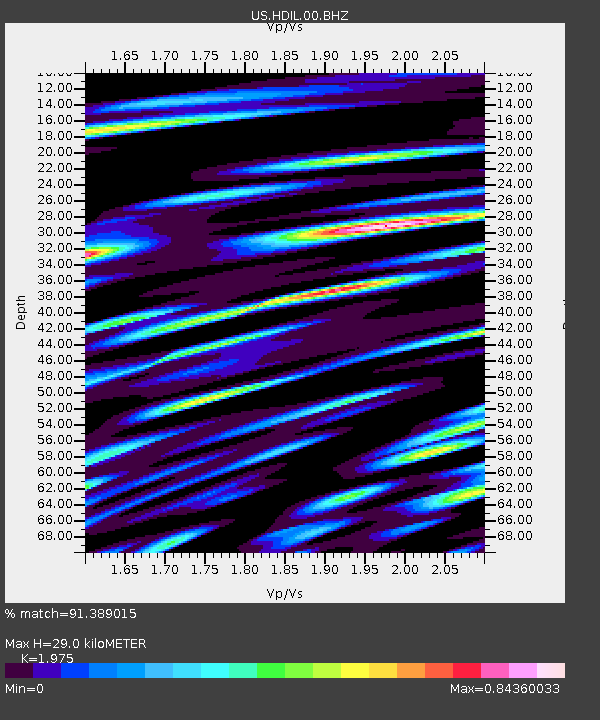
HDIL Hopedale, Illinois, USA - Earthquake Result Viewer
| ||||||||||||||||||
| ||||||||||||||||||
| ||||||||||||||||||
|
Signal To Noise
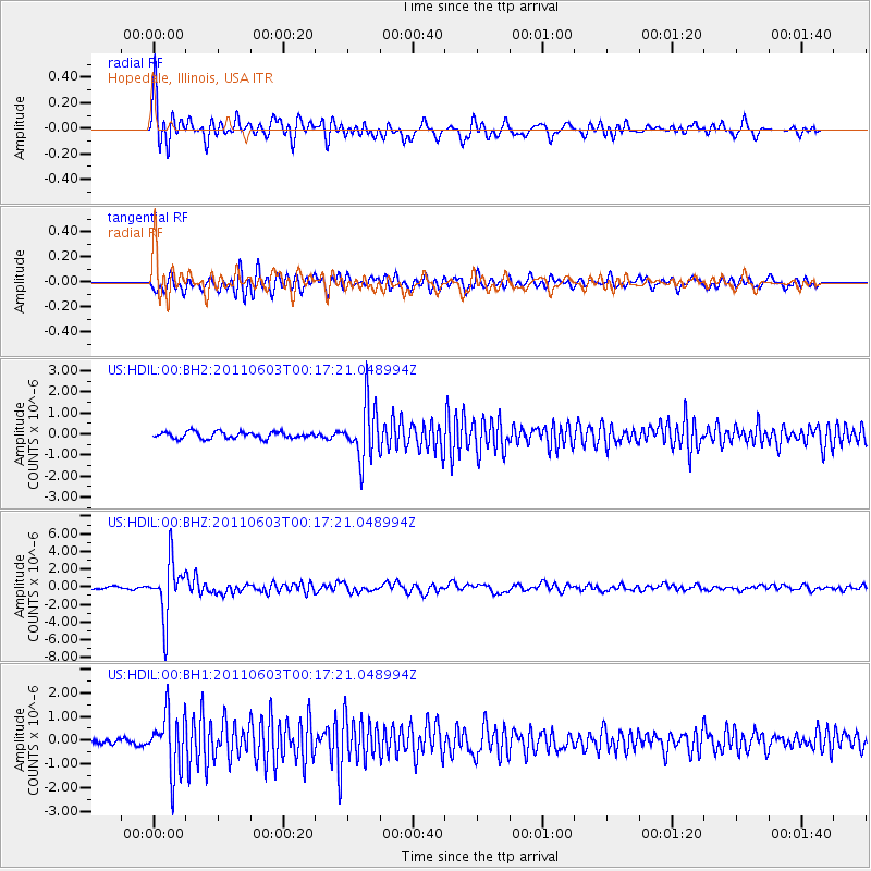
| Channel | StoN | STA | LTA |
| US:HDIL:00:BHZ:20110603T00:17:21.048994Z | 14.438471 | 3.1390489E-6 | 2.1740868E-7 |
| US:HDIL:00:BH1:20110603T00:17:21.048994Z | 5.971374 | 1.226257E-6 | 2.0535593E-7 |
| US:HDIL:00:BH2:20110603T00:17:21.048994Z | 8.06284 | 1.2754579E-6 | 1.5818965E-7 |
| Arrivals | |
| Ps | 4.4 SECOND |
| PpPs | 13 SECOND |
| PsPs/PpSs | 17 SECOND |

