You are here: Home > Network List > IU - Global Seismograph Network (GSN - IRIS/USGS) Stations List
> Station HNR Honiara, Solomon Islands > Earthquake Result Viewer
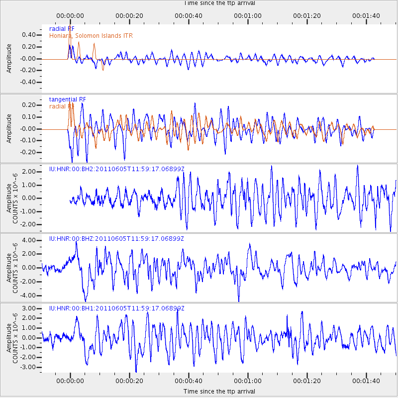
HNR Honiara, Solomon Islands - Earthquake Result Viewer
*The percent match for this event was below the threshold and hence no stack was calculated.
| Earthquake location: |
West Of Macquarie Island |
| Earthquake latitude/longitude: |
-55.8/146.6 |
| Earthquake time(UTC): |
2011/06/05 (156) 11:51:12 GMT |
| Earthquake Depth: |
3.0 km |
| Earthquake Magnitude: |
5.9 MB, 6.4 MS, 6.4 MW, 6.4 MW |
| Earthquake Catalog/Contributor: |
WHDF/NEIC |
|
| Network: |
IU Global Seismograph Network (GSN - IRIS/USGS) |
| Station: |
HNR Honiara, Solomon Islands |
| Lat/Lon: |
9.44 S/159.95 E |
| Elevation: |
100 m |
|
| Distance: |
47.5 deg |
| Az: |
17.979 deg |
| Baz: |
190.163 deg |
| Ray Param: |
$rayparam |
*The percent match for this event was below the threshold and hence was not used in the summary stack. |
|
| Radial Match: |
56.406933 % |
| Radial Bump: |
400 |
| Transverse Match: |
66.70563 % |
| Transverse Bump: |
400 |
| SOD ConfigId: |
558545 |
| Insert Time: |
2013-09-18 19:25:47.390 +0000 |
| GWidth: |
2.5 |
| Max Bumps: |
400 |
| Tol: |
0.001 |
|
Signal To Noise
| Channel | StoN | STA | LTA |
| IU:HNR:00:BHZ:20110605T11:59:17.06899Z | 5.301251 | 1.9891088E-6 | 3.7521497E-7 |
| IU:HNR:00:BH1:20110605T11:59:17.06899Z | 2.4257848 | 9.520358E-7 | 3.9246507E-7 |
| IU:HNR:00:BH2:20110605T11:59:17.06899Z | 0.97848314 | 4.1873304E-7 | 4.27941E-7 |
| Arrivals |
| Ps | |
| PpPs | |
| PsPs/PpSs | |


