You are here: Home > Network List > US - United States National Seismic Network Stations List
> Station DGMT Dagmar, Montana, USA > Earthquake Result Viewer
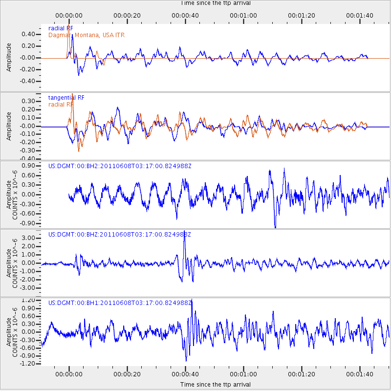
DGMT Dagmar, Montana, USA - Earthquake Result Viewer
*The percent match for this event was below the threshold and hence no stack was calculated.
| Earthquake location: |
Peru-Bolivia Border Region |
| Earthquake latitude/longitude: |
-17.1/-69.5 |
| Earthquake time(UTC): |
2011/06/08 (159) 03:06:22 GMT |
| Earthquake Depth: |
146 km |
| Earthquake Magnitude: |
5.8 MB, 5.9 MW, 5.9 MW |
| Earthquake Catalog/Contributor: |
WHDF/NEIC |
|
| Network: |
US United States National Seismic Network |
| Station: |
DGMT Dagmar, Montana, USA |
| Lat/Lon: |
48.47 N/104.20 W |
| Elevation: |
0.0 m |
|
| Distance: |
72.2 deg |
| Az: |
336.568 deg |
| Baz: |
145.146 deg |
| Ray Param: |
$rayparam |
*The percent match for this event was below the threshold and hence was not used in the summary stack. |
|
| Radial Match: |
61.477013 % |
| Radial Bump: |
400 |
| Transverse Match: |
49.79908 % |
| Transverse Bump: |
400 |
| SOD ConfigId: |
558545 |
| Insert Time: |
2013-09-18 19:32:17.500 +0000 |
| GWidth: |
2.5 |
| Max Bumps: |
400 |
| Tol: |
0.001 |
|
Signal To Noise
| Channel | StoN | STA | LTA |
| US:DGMT:00:BHZ:20110608T03:17:00.824988Z | 4.808107 | 5.610991E-7 | 1.1669856E-7 |
| US:DGMT:00:BH1:20110608T03:17:00.824988Z | 0.6269754 | 1.2956244E-7 | 2.0664676E-7 |
| US:DGMT:00:BH2:20110608T03:17:00.824988Z | 1.2745143 | 2.3962983E-7 | 1.8801657E-7 |
| Arrivals |
| Ps | |
| PpPs | |
| PsPs/PpSs | |


