You are here: Home > Network List > US - United States National Seismic Network Stations List
> Station DUG Dugway, Tooele County, Utah, USA > Earthquake Result Viewer
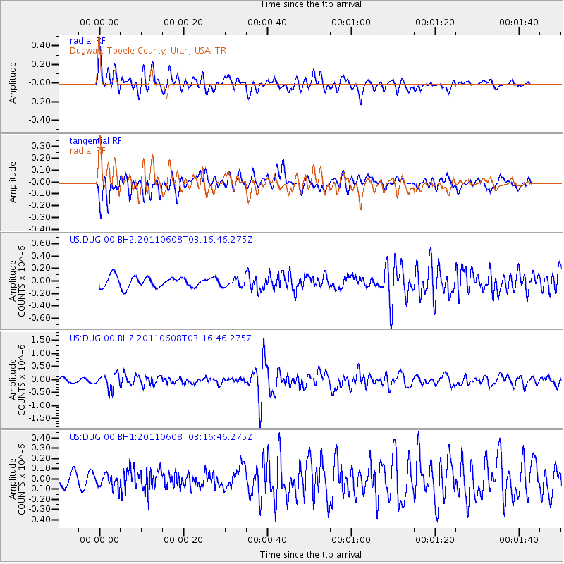
DUG Dugway, Tooele County, Utah, USA - Earthquake Result Viewer
*The percent match for this event was below the threshold and hence no stack was calculated.
| Earthquake location: |
Peru-Bolivia Border Region |
| Earthquake latitude/longitude: |
-17.1/-69.5 |
| Earthquake time(UTC): |
2011/06/08 (159) 03:06:22 GMT |
| Earthquake Depth: |
146 km |
| Earthquake Magnitude: |
5.8 MB, 5.9 MW, 5.9 MW |
| Earthquake Catalog/Contributor: |
WHDF/NEIC |
|
| Network: |
US United States National Seismic Network |
| Station: |
DUG Dugway, Tooele County, Utah, USA |
| Lat/Lon: |
40.19 N/112.81 W |
| Elevation: |
1477 m |
|
| Distance: |
69.8 deg |
| Az: |
325.961 deg |
| Baz: |
135.659 deg |
| Ray Param: |
$rayparam |
*The percent match for this event was below the threshold and hence was not used in the summary stack. |
|
| Radial Match: |
75.8564 % |
| Radial Bump: |
400 |
| Transverse Match: |
72.43272 % |
| Transverse Bump: |
400 |
| SOD ConfigId: |
558545 |
| Insert Time: |
2013-09-18 19:32:18.065 +0000 |
| GWidth: |
2.5 |
| Max Bumps: |
400 |
| Tol: |
0.001 |
|
Signal To Noise
| Channel | StoN | STA | LTA |
| US:DUG:00:BHZ:20110608T03:16:46.275Z | 3.9759552 | 2.7440365E-7 | 6.9015776E-8 |
| US:DUG:00:BH1:20110608T03:16:46.275Z | 0.79523546 | 6.4875955E-8 | 8.158082E-8 |
| US:DUG:00:BH2:20110608T03:16:46.275Z | 0.79284346 | 6.6811154E-8 | 8.4267775E-8 |
| Arrivals |
| Ps | |
| PpPs | |
| PsPs/PpSs | |


