You are here: Home > Network List > IU - Global Seismograph Network (GSN - IRIS/USGS) Stations List
> Station PMG Port Moresby, New Guinea > Earthquake Result Viewer
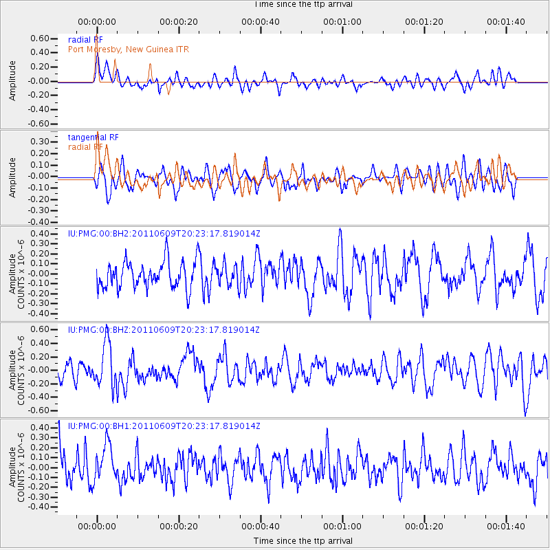
PMG Port Moresby, New Guinea - Earthquake Result Viewer
*The percent match for this event was below the threshold and hence no stack was calculated.
| Earthquake location: |
Kermadec Islands, New Zealand |
| Earthquake latitude/longitude: |
-30.4/-178.1 |
| Earthquake time(UTC): |
2011/06/09 (160) 20:16:28 GMT |
| Earthquake Depth: |
31 km |
| Earthquake Magnitude: |
5.6 MW, 5.6 MW |
| Earthquake Catalog/Contributor: |
NEIC PDE/NEIC PDE-M |
|
| Network: |
IU Global Seismograph Network (GSN - IRIS/USGS) |
| Station: |
PMG Port Moresby, New Guinea |
| Lat/Lon: |
9.40 S/147.16 E |
| Elevation: |
90 m |
|
| Distance: |
38.6 deg |
| Az: |
295.462 deg |
| Baz: |
127.777 deg |
| Ray Param: |
$rayparam |
*The percent match for this event was below the threshold and hence was not used in the summary stack. |
|
| Radial Match: |
60.944466 % |
| Radial Bump: |
400 |
| Transverse Match: |
62.37341 % |
| Transverse Bump: |
400 |
| SOD ConfigId: |
558545 |
| Insert Time: |
2013-09-18 19:36:38.425 +0000 |
| GWidth: |
2.5 |
| Max Bumps: |
400 |
| Tol: |
0.001 |
|
Signal To Noise
| Channel | StoN | STA | LTA |
| IU:PMG:00:BHZ:20110609T20:23:17.819014Z | 2.9704473 | 3.350631E-7 | 1.12798865E-7 |
| IU:PMG:00:BH1:20110609T20:23:17.819014Z | 1.3610971 | 1.9057516E-7 | 1.4001584E-7 |
| IU:PMG:00:BH2:20110609T20:23:17.819014Z | 0.7689812 | 1.0260904E-7 | 1.3343504E-7 |
| Arrivals |
| Ps | |
| PpPs | |
| PsPs/PpSs | |


