You are here: Home > Network List > II - Global Seismograph Network (GSN - IRIS/IDA) Stations List
> Station PFO Pinon Flat, California, USA > Earthquake Result Viewer
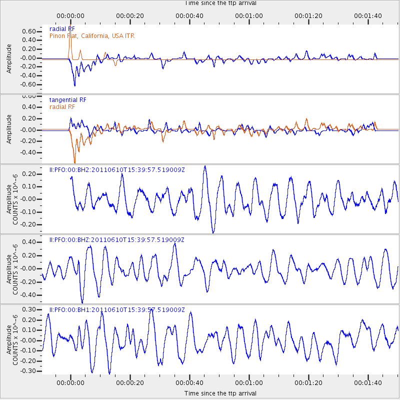
PFO Pinon Flat, California, USA - Earthquake Result Viewer
*The percent match for this event was below the threshold and hence no stack was calculated.
| Earthquake location: |
South Pacific Ocean |
| Earthquake latitude/longitude: |
-6.7/-122.7 |
| Earthquake time(UTC): |
2011/06/10 (161) 15:32:48 GMT |
| Earthquake Depth: |
10 km |
| Earthquake Magnitude: |
5.5 MB |
| Earthquake Catalog/Contributor: |
NEIC PDE/NEIC PDE-M |
|
| Network: |
II Global Seismograph Network (GSN - IRIS/IDA) |
| Station: |
PFO Pinon Flat, California, USA |
| Lat/Lon: |
33.61 N/116.46 W |
| Elevation: |
1280 m |
|
| Distance: |
40.6 deg |
| Az: |
8.074 deg |
| Baz: |
189.622 deg |
| Ray Param: |
$rayparam |
*The percent match for this event was below the threshold and hence was not used in the summary stack. |
|
| Radial Match: |
48.7844 % |
| Radial Bump: |
400 |
| Transverse Match: |
57.153004 % |
| Transverse Bump: |
400 |
| SOD ConfigId: |
558545 |
| Insert Time: |
2013-09-18 19:38:13.450 +0000 |
| GWidth: |
2.5 |
| Max Bumps: |
400 |
| Tol: |
0.001 |
|
Signal To Noise
| Channel | StoN | STA | LTA |
| II:PFO:00:BHZ:20110610T15:39:57.519009Z | 2.0932772 | 2.2645355E-7 | 1.0818135E-7 |
| II:PFO:00:BH1:20110610T15:39:57.519009Z | 0.7465983 | 8.306508E-8 | 1.1125806E-7 |
| II:PFO:00:BH2:20110610T15:39:57.519009Z | 0.7809894 | 6.137634E-8 | 7.858794E-8 |
| Arrivals |
| Ps | |
| PpPs | |
| PsPs/PpSs | |


