You are here: Home > Network List > US - United States National Seismic Network Stations List
> Station MSO Missoula, Montana, USA > Earthquake Result Viewer
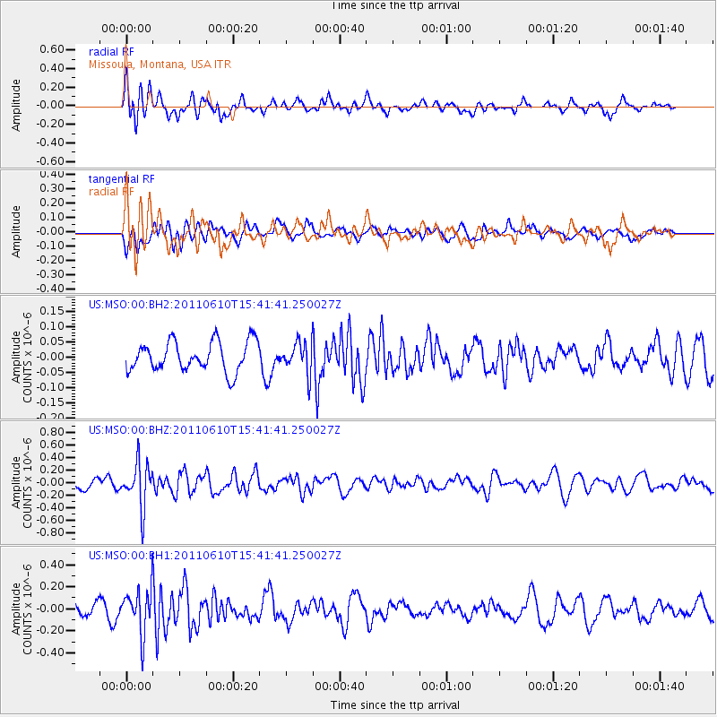
MSO Missoula, Montana, USA - Earthquake Result Viewer
*The percent match for this event was below the threshold and hence no stack was calculated.
| Earthquake location: |
South Pacific Ocean |
| Earthquake latitude/longitude: |
-6.7/-122.7 |
| Earthquake time(UTC): |
2011/06/10 (161) 15:32:48 GMT |
| Earthquake Depth: |
10 km |
| Earthquake Magnitude: |
5.5 MB |
| Earthquake Catalog/Contributor: |
NEIC PDE/NEIC PDE-M |
|
| Network: |
US United States National Seismic Network |
| Station: |
MSO Missoula, Montana, USA |
| Lat/Lon: |
46.83 N/113.94 W |
| Elevation: |
1264 m |
|
| Distance: |
53.9 deg |
| Az: |
7.468 deg |
| Baz: |
190.837 deg |
| Ray Param: |
$rayparam |
*The percent match for this event was below the threshold and hence was not used in the summary stack. |
|
| Radial Match: |
67.056046 % |
| Radial Bump: |
400 |
| Transverse Match: |
68.93785 % |
| Transverse Bump: |
400 |
| SOD ConfigId: |
558545 |
| Insert Time: |
2013-09-18 19:40:54.520 +0000 |
| GWidth: |
2.5 |
| Max Bumps: |
400 |
| Tol: |
0.001 |
|
Signal To Noise
| Channel | StoN | STA | LTA |
| US:MSO:00:BHZ:20110610T15:41:41.250027Z | 4.471451 | 3.5704255E-7 | 7.984938E-8 |
| US:MSO:00:BH1:20110610T15:41:41.250027Z | 3.250303 | 2.0466702E-7 | 6.2968596E-8 |
| US:MSO:00:BH2:20110610T15:41:41.250027Z | 1.0458473 | 5.110385E-8 | 4.8863587E-8 |
| Arrivals |
| Ps | |
| PpPs | |
| PsPs/PpSs | |


