You are here: Home > Network List > US - United States National Seismic Network Stations List
> Station TPNV Topopah Spring, Nevada, USA > Earthquake Result Viewer
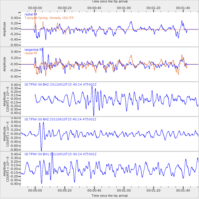
TPNV Topopah Spring, Nevada, USA - Earthquake Result Viewer
*The percent match for this event was below the threshold and hence no stack was calculated.
| Earthquake location: |
South Pacific Ocean |
| Earthquake latitude/longitude: |
-6.7/-122.7 |
| Earthquake time(UTC): |
2011/06/10 (161) 15:32:48 GMT |
| Earthquake Depth: |
10 km |
| Earthquake Magnitude: |
5.5 MB |
| Earthquake Catalog/Contributor: |
NEIC PDE/NEIC PDE-M |
|
| Network: |
US United States National Seismic Network |
| Station: |
TPNV Topopah Spring, Nevada, USA |
| Lat/Lon: |
36.95 N/116.25 W |
| Elevation: |
1600 m |
|
| Distance: |
43.9 deg |
| Az: |
7.506 deg |
| Baz: |
189.32 deg |
| Ray Param: |
$rayparam |
*The percent match for this event was below the threshold and hence was not used in the summary stack. |
|
| Radial Match: |
65.582634 % |
| Radial Bump: |
400 |
| Transverse Match: |
73.20885 % |
| Transverse Bump: |
400 |
| SOD ConfigId: |
558545 |
| Insert Time: |
2013-09-18 19:41:24.808 +0000 |
| GWidth: |
2.5 |
| Max Bumps: |
400 |
| Tol: |
0.001 |
|
Signal To Noise
| Channel | StoN | STA | LTA |
| US:TPNV:00:BHZ:20110610T15:40:24.475002Z | 4.7131653 | 3.3209247E-7 | 7.04606E-8 |
| US:TPNV:00:BH1:20110610T15:40:24.475002Z | 2.0963924 | 1.6170468E-7 | 7.7134736E-8 |
| US:TPNV:00:BH2:20110610T15:40:24.475002Z | 1.7380378 | 1.2895096E-7 | 7.4193416E-8 |
| Arrivals |
| Ps | |
| PpPs | |
| PsPs/PpSs | |


