You are here: Home > Network List > II - Global Seismograph Network (GSN - IRIS/IDA) Stations List
> Station WRAB Tennant Creek, NT, Australia > Earthquake Result Viewer
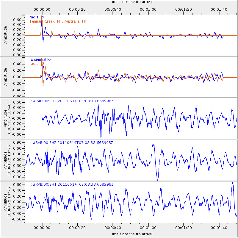
WRAB Tennant Creek, NT, Australia - Earthquake Result Viewer
*The percent match for this event was below the threshold and hence no stack was calculated.
| Earthquake location: |
Northern Sumatra, Indonesia |
| Earthquake latitude/longitude: |
1.8/99.1 |
| Earthquake time(UTC): |
2011/06/14 (165) 03:01:29 GMT |
| Earthquake Depth: |
22 km |
| Earthquake Magnitude: |
5.6 MW, 5.5 MS, 5.6 MW |
| Earthquake Catalog/Contributor: |
NEIC PDE/NEIC PDE-M |
|
| Network: |
II Global Seismograph Network (GSN - IRIS/IDA) |
| Station: |
WRAB Tennant Creek, NT, Australia |
| Lat/Lon: |
19.93 S/134.36 E |
| Elevation: |
366 m |
|
| Distance: |
40.8 deg |
| Az: |
123.785 deg |
| Baz: |
297.998 deg |
| Ray Param: |
$rayparam |
*The percent match for this event was below the threshold and hence was not used in the summary stack. |
|
| Radial Match: |
44.743374 % |
| Radial Bump: |
400 |
| Transverse Match: |
63.108646 % |
| Transverse Bump: |
400 |
| SOD ConfigId: |
558545 |
| Insert Time: |
2013-09-18 19:49:13.329 +0000 |
| GWidth: |
2.5 |
| Max Bumps: |
400 |
| Tol: |
0.001 |
|
Signal To Noise
| Channel | StoN | STA | LTA |
| II:WRAB:00:BHZ:20110614T03:08:38.668998Z | 1.6528417 | 2.812535E-7 | 1.7016362E-7 |
| II:WRAB:00:BH1:20110614T03:08:38.668998Z | 1.1081253 | 1.8651686E-7 | 1.6831748E-7 |
| II:WRAB:00:BH2:20110614T03:08:38.668998Z | 2.5795767 | 3.0233645E-7 | 1.172039E-7 |
| Arrivals |
| Ps | |
| PpPs | |
| PsPs/PpSs | |


