You are here: Home > Network List > II - Global Seismograph Network (GSN - IRIS/IDA) Stations List
> Station WRAB Tennant Creek, NT, Australia > Earthquake Result Viewer
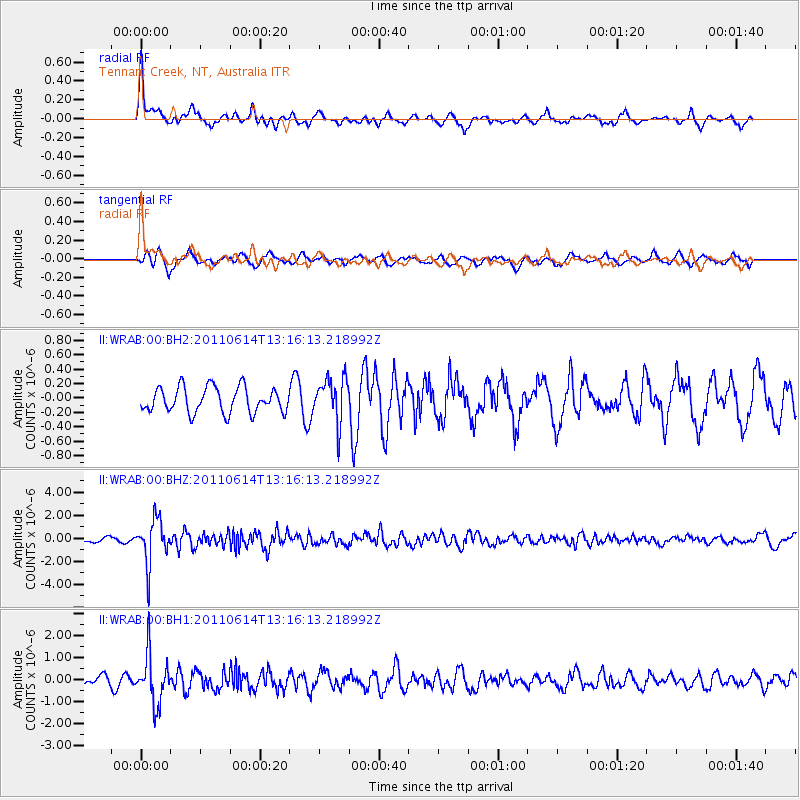
WRAB Tennant Creek, NT, Australia - Earthquake Result Viewer
*The percent match for this event was below the threshold and hence no stack was calculated.
| Earthquake location: |
Off East Coast Of Honshu, Japan |
| Earthquake latitude/longitude: |
37.7/143.5 |
| Earthquake time(UTC): |
2011/06/14 (165) 13:06:52 GMT |
| Earthquake Depth: |
14 km |
| Earthquake Magnitude: |
5.7 MW, 5.7 MB, 5.8 MW |
| Earthquake Catalog/Contributor: |
NEIC PDE/NEIC PDE-M |
|
| Network: |
II Global Seismograph Network (GSN - IRIS/IDA) |
| Station: |
WRAB Tennant Creek, NT, Australia |
| Lat/Lon: |
19.93 S/134.36 E |
| Elevation: |
366 m |
|
| Distance: |
58.0 deg |
| Az: |
190.164 deg |
| Baz: |
8.553 deg |
| Ray Param: |
$rayparam |
*The percent match for this event was below the threshold and hence was not used in the summary stack. |
|
| Radial Match: |
76.902245 % |
| Radial Bump: |
368 |
| Transverse Match: |
66.94601 % |
| Transverse Bump: |
385 |
| SOD ConfigId: |
558545 |
| Insert Time: |
2013-09-18 19:50:23.322 +0000 |
| GWidth: |
2.5 |
| Max Bumps: |
400 |
| Tol: |
0.001 |
|
Signal To Noise
| Channel | StoN | STA | LTA |
| II:WRAB:00:BHZ:20110614T13:16:13.218992Z | 7.835031 | 1.911091E-6 | 2.4391622E-7 |
| II:WRAB:00:BH1:20110614T13:16:13.218992Z | 5.2681193 | 1.0968596E-6 | 2.0820704E-7 |
| II:WRAB:00:BH2:20110614T13:16:13.218992Z | 1.7648227 | 3.0784557E-7 | 1.7443426E-7 |
| Arrivals |
| Ps | |
| PpPs | |
| PsPs/PpSs | |


