You are here: Home > Network List > US - United States National Seismic Network Stations List
> Station AMTX Amarillo, Texas, USA > Earthquake Result Viewer
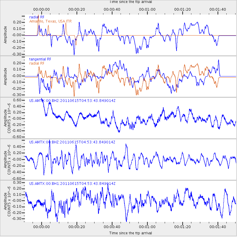
AMTX Amarillo, Texas, USA - Earthquake Result Viewer
*The percent match for this event was below the threshold and hence no stack was calculated.
| Earthquake location: |
Bonin Islands, Japan Region |
| Earthquake latitude/longitude: |
26.8/144.1 |
| Earthquake time(UTC): |
2011/06/15 (166) 04:41:03 GMT |
| Earthquake Depth: |
10 km |
| Earthquake Magnitude: |
5.5 MB |
| Earthquake Catalog/Contributor: |
NEIC PDE/NEIC PDE-M |
|
| Network: |
US United States National Seismic Network |
| Station: |
AMTX Amarillo, Texas, USA |
| Lat/Lon: |
34.53 N/101.41 W |
| Elevation: |
1010 m |
|
| Distance: |
93.0 deg |
| Az: |
48.8 deg |
| Baz: |
305.447 deg |
| Ray Param: |
$rayparam |
*The percent match for this event was below the threshold and hence was not used in the summary stack. |
|
| Radial Match: |
46.54665 % |
| Radial Bump: |
400 |
| Transverse Match: |
25.591578 % |
| Transverse Bump: |
400 |
| SOD ConfigId: |
558545 |
| Insert Time: |
2013-09-18 19:55:04.631 +0000 |
| GWidth: |
2.5 |
| Max Bumps: |
400 |
| Tol: |
0.001 |
|
Signal To Noise
| Channel | StoN | STA | LTA |
| US:AMTX:00:BHZ:20110615T04:53:43.849014Z | 2.102138 | 2.4813247E-7 | 1.1803814E-7 |
| US:AMTX:00:BH1:20110615T04:53:43.849014Z | 1.1440601 | 1.775525E-7 | 1.5519507E-7 |
| US:AMTX:00:BH2:20110615T04:53:43.849014Z | 1.0218673 | 1.6077637E-7 | 1.5733588E-7 |
| Arrivals |
| Ps | |
| PpPs | |
| PsPs/PpSs | |


