You are here: Home > Network List > US - United States National Seismic Network Stations List
> Station EGMT Eagleton, Montana, USA > Earthquake Result Viewer
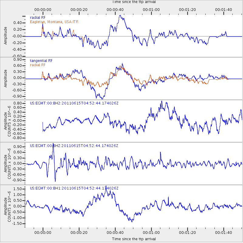
EGMT Eagleton, Montana, USA - Earthquake Result Viewer
*The percent match for this event was below the threshold and hence no stack was calculated.
| Earthquake location: |
Bonin Islands, Japan Region |
| Earthquake latitude/longitude: |
26.8/144.1 |
| Earthquake time(UTC): |
2011/06/15 (166) 04:41:03 GMT |
| Earthquake Depth: |
10 km |
| Earthquake Magnitude: |
5.5 MB |
| Earthquake Catalog/Contributor: |
NEIC PDE/NEIC PDE-M |
|
| Network: |
US United States National Seismic Network |
| Station: |
EGMT Eagleton, Montana, USA |
| Lat/Lon: |
48.02 N/109.75 W |
| Elevation: |
1055 m |
|
| Distance: |
80.5 deg |
| Az: |
40.834 deg |
| Baz: |
299.463 deg |
| Ray Param: |
$rayparam |
*The percent match for this event was below the threshold and hence was not used in the summary stack. |
|
| Radial Match: |
41.256653 % |
| Radial Bump: |
400 |
| Transverse Match: |
16.424967 % |
| Transverse Bump: |
400 |
| SOD ConfigId: |
558545 |
| Insert Time: |
2013-09-18 19:55:24.150 +0000 |
| GWidth: |
2.5 |
| Max Bumps: |
400 |
| Tol: |
0.001 |
|
Signal To Noise
| Channel | StoN | STA | LTA |
| US:EGMT:00:BHZ:20110615T04:52:44.174026Z | 4.5586815 | 2.9154654E-7 | 6.395413E-8 |
| US:EGMT:00:BH1:20110615T04:52:44.174026Z | 1.4554576 | 2.3332593E-7 | 1.6031106E-7 |
| US:EGMT:00:BH2:20110615T04:52:44.174026Z | 1.2861948 | 2.1670769E-7 | 1.6848746E-7 |
| Arrivals |
| Ps | |
| PpPs | |
| PsPs/PpSs | |


