You are here: Home > Network List > US - United States National Seismic Network Stations List
> Station HAWA Hanford, Washington, USA > Earthquake Result Viewer
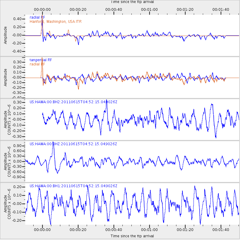
HAWA Hanford, Washington, USA - Earthquake Result Viewer
*The percent match for this event was below the threshold and hence no stack was calculated.
| Earthquake location: |
Bonin Islands, Japan Region |
| Earthquake latitude/longitude: |
26.8/144.1 |
| Earthquake time(UTC): |
2011/06/15 (166) 04:41:03 GMT |
| Earthquake Depth: |
10 km |
| Earthquake Magnitude: |
5.5 MB |
| Earthquake Catalog/Contributor: |
NEIC PDE/NEIC PDE-M |
|
| Network: |
US United States National Seismic Network |
| Station: |
HAWA Hanford, Washington, USA |
| Lat/Lon: |
46.39 N/119.53 W |
| Elevation: |
364 m |
|
| Distance: |
75.2 deg |
| Az: |
45.349 deg |
| Baz: |
293.253 deg |
| Ray Param: |
$rayparam |
*The percent match for this event was below the threshold and hence was not used in the summary stack. |
|
| Radial Match: |
57.367874 % |
| Radial Bump: |
400 |
| Transverse Match: |
56.676617 % |
| Transverse Bump: |
400 |
| SOD ConfigId: |
558545 |
| Insert Time: |
2013-09-18 19:55:28.936 +0000 |
| GWidth: |
2.5 |
| Max Bumps: |
400 |
| Tol: |
0.001 |
|
Signal To Noise
| Channel | StoN | STA | LTA |
| US:HAWA:00:BHZ:20110615T04:52:15.049026Z | 2.4326663 | 2.3990228E-7 | 9.861701E-8 |
| US:HAWA:00:BH1:20110615T04:52:15.049026Z | 1.5245492 | 1.176942E-7 | 7.7199346E-8 |
| US:HAWA:00:BH2:20110615T04:52:15.049026Z | 1.1485987 | 9.999053E-8 | 8.705437E-8 |
| Arrivals |
| Ps | |
| PpPs | |
| PsPs/PpSs | |


